| Binsey - Overview |
 |
|
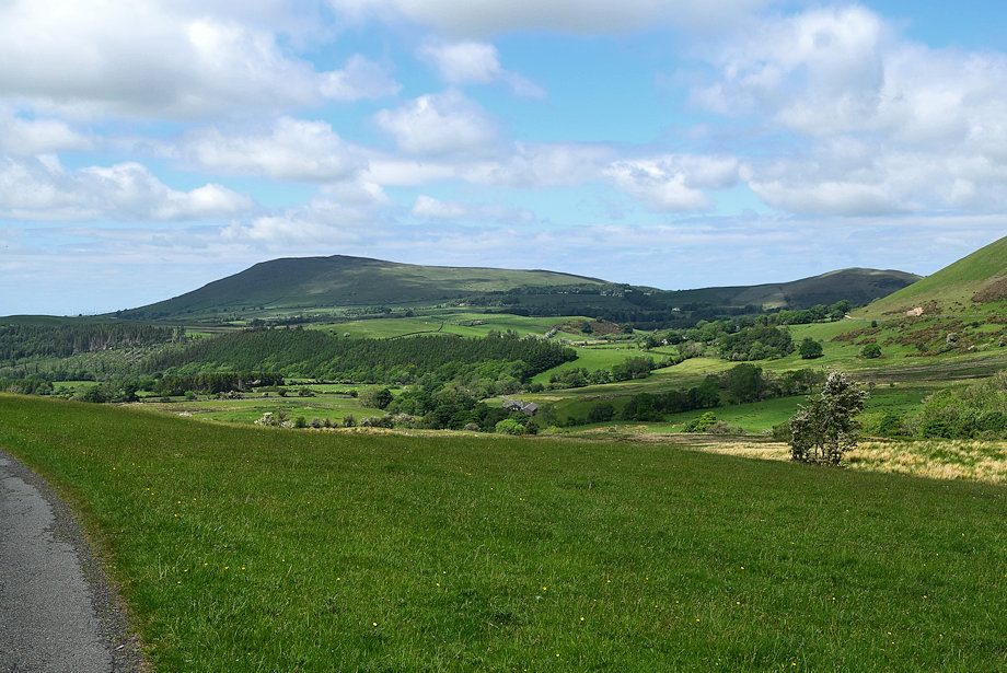 |
| Binsey and Latrigg from the road to Dash Farm |
|
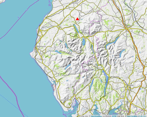
Binsey lies in the extreme north-west of the Northern Fells and stands isolated from the rest of the group. It is the highest point of a low ridge, some 5 miles long which extends west from Caer Mote (St. John's Hill) to Latrigg to the east of Binsey. The ridge forms the watershed between the River Derwent to the south and the River Ellen to the north. Much of the area around the base of the fell to the north is enclosed pasture and access to the summit is only possible from the south where public footpaths lead onto Open Access Land. The fell is mainly cloaked in grass and lank heather with occasional outcrops of rock, the main one being West Crag, a favourite launching point for hang gliders and parascenders. The underlying rock, unlike most of the Northern Fells, is volcanic in origin and is considered to be a detached extension of the Borrowdale Volcanic Series. There are several small disused quarries on the lower eastern slopes where this durable stone was extracted for building material. Binsey provides very easy fellwalking for beginners and family groups, save it for an afternoon or early evening walk in late summer when the heather is in flower. |
| Routes of Ascent |
 |
|
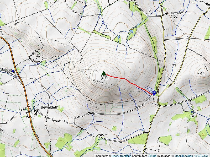
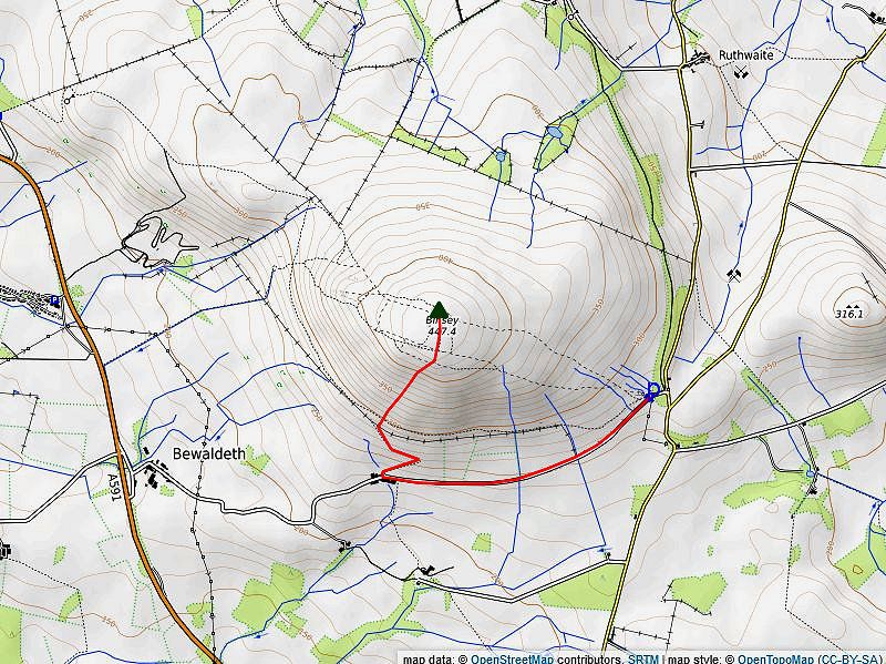
Ascent from Binsey Lodge (1) More details of this route can be seen here Distance - 0.7 mile |
 |
|
Ascent from Fell End (2) There is no opportunity to park near to Fell End Farm so walk along the quiet lane from the parking area near Binsey Lodge for almost a mile to reach the farm. Go through the gate to the right of the farmhouse which has a bridleway sign. The bridleway zig zags through the pastures above the farm to a handgate in the intake wall. Climb the steep slope above the gate over grass and the occasional clumps of heather, there is little trace of a path, just aim north-north east. After gaining 400 feet of ascent from the gate the angle of the slope eases and a clear path appears through the now predominate heather which climbs easily to join the wide path below the summit of Binsey. Distance - 1.65 miles |
 |
|
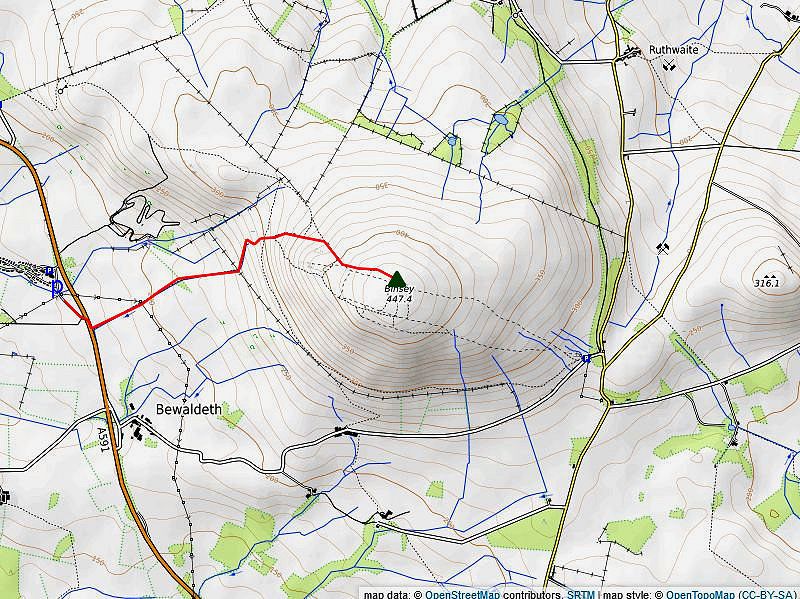
Ascent from the North Lakes Caravan Park (3) There is ample parking on a loop of the old road near the entrance to the North Lakes Caravan Park. Cross the A591 road and go through the gate which is almost opposite the caravan park's entrance onto a tree-lined green lane which rises gently to another gate. The lane becomes more open as it rises, slightly more steeply, through a pasture to a gate in the intake wall with West Crag on Binsey dominating the view ahead. Above the gate a good path veers left rising amid scattered trees towards an old gravel pit. The path, less obvious now, sweeps around the pit then climbs steadily, becoming a little clearer as height is gained, to join a wide green path on the ridge above which comes up to that point from Whittas Park. Turn right on this path which rises easily towards the summit. A thin path breaks off to the left on the final approach to visit the prominent north-western cairn which occupies a fine viewpoint. Distance - 1.5 miles |
 ) ) |
|
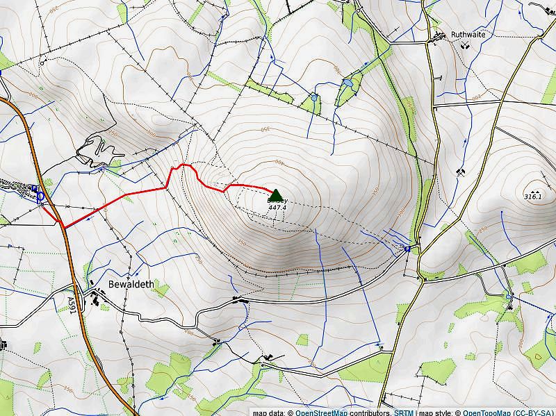
Ascent via West Crag (4) This is a very worthwhile variation of the third route. On the slope above the old gravel pit an indistinct path breaks off to the right near a solitary windswept tree and makes a rising traverse across the grass slope towards West Crag. On approaching the lowest rocks of the crag, the path turns up and climbs steeply alongside the edge of the crag before veering right to reach the crag's wide grassy top. The view from West Crag is very good, in some respects much better than that from Binsey's summit. Continue eastwards from the top of the crag for a short distance, there is only a mere trace of path for 20-30 yards, to re-join the above route as it approaches to the summit. More details of this route can be seen here Distance - 1.4 miles |
| The Summit |
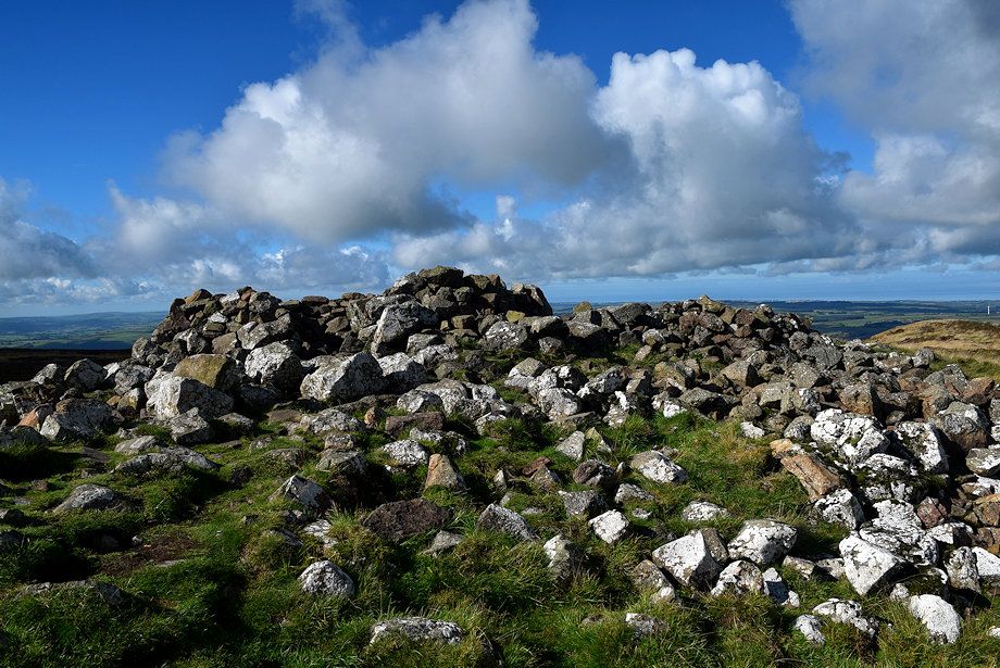 |
| The ancient tumulus on the summit of Binsey |
| Grass and heather give way to embedded rocks on the crest of the summit which is occupied by a trig column and a large Bronze Age tumulus which sadly has been ransacked to construct several wind shelters. One theory suggests that the tumulus gives Binsey its name - 'Hill of the Heap' (of stones) A cairn stands a short distance to the east of the tumulus while another lies further along the ridge to the north-west. Both cairns mark good viewpoints |
| The View |
|
The view more than amply rewards the easy climb to reach the summit. To the south-east the Uldale Fells and the Skiddaw group are seen from an unusual angle, the Dash Valley between them with Blencatha towering above its head. Due south, the Scafell group with the Coniston Fells making an appearence to their left, almost 25 miles away. |
|
Safe Descents In hill fog the descent via West Crag should be avoided, the path is vague and the ground is rough and very steep by the edge of the crag. The southern slopes can be descended without hazard to the bridleway gate in the intake wall which can be found to the right of a small copse of trees at Grid Reference NY 22146 34998. The wide path just to the south of the summit gives safe passage east to Binsey Lodge or west towards Whittas Park. There is no public right of way beyond the boundary wall of Whittas Park so bear left at a fork in the path at Grid Reference NY 22099 35766 and descend past the disused gravel pit to reach the green lane leading to the main road near the entrance to the North Lakes Caravan Park. |
|

