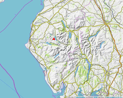
| Mellbreak - Overview |
 |
|
 |
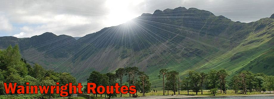
| Mellbreak from Lanthwaite Green |
| Mellbreak, although regarded as part of the Loweswater Fells stands isolated from the rest of the group being seperated from its companions by the wide and marshy Mosedale valley. The fell takes the form of a two mile long ridge with twin summits of similar height two thirds of a mile apart which are seperated by a wide depression, the southern top, a mere ten feet higher than the northern one is the true summit of the fell. There is another subsidiary top, Scale Knott, lower down on its grassy southern ridge which rises evenly from Scale Beck and its tributary Black Beck. By contrast the north ridge falls abruptly over a series of crags to the pastures of High Park. Melbreak's eastern slopes, riven by crags and gullies, sweep down steeply to the western shore of Crummock Water which forms its eastern boundary. The western slopes, overlooking Mosedale Beck, are plainer but no less steep, being mainly covered by heather and grass with rocky outcrops and tongues of scree. With no connecting ridges to other fells the ascent of Mellbreak only offers a short days outing for walkers, most choose to traverse the fell from either Buttermere or Loweswater and return by the popular footpath alongside Crummock Water's western shore. |
| Routes of Ascent |
 |
|
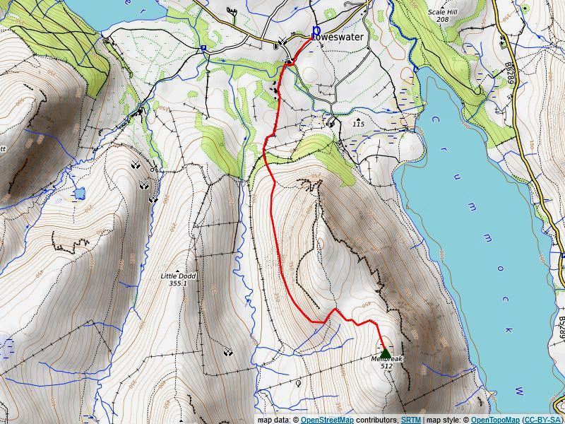
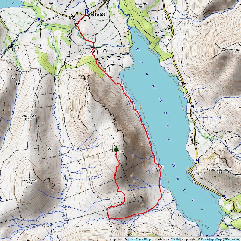
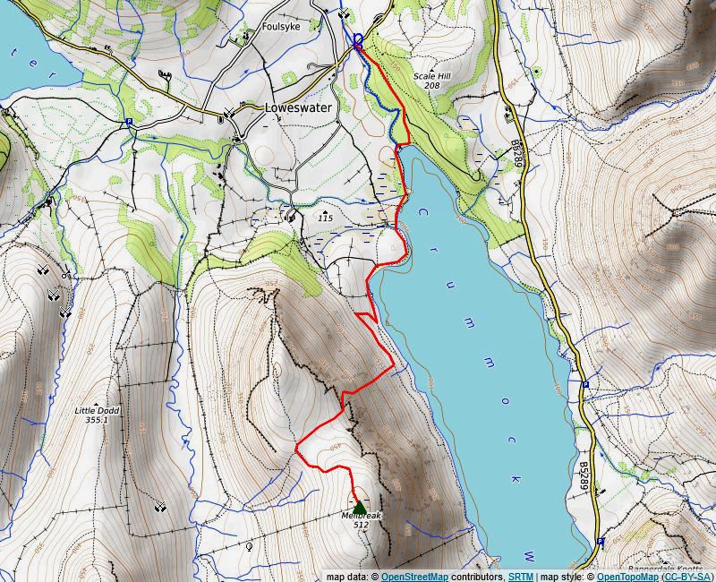
From Loweswater via the North Ridge (1) This is the most popular way to climb Mellbreak from Loweswater. There are a few spaces to leave a car near the telephone box at the road junction. Walk past the Kirkstile Inn to Church Bridge. Mellbreak's north ridge, with its three tiers of crags, looks quite formidable when seen from the bridge but there is a clear path which avoids all difficulties. From the bridge walk along the metalled road to Kirkhead Farm, past the farm the road becomes a walled bridleway which leads on for a further third of a mile to a gate. The bridleway turns right towards Mosedale, leave it at that point and continue straight ahead on a path through a firebreak in a stand of larch trees to reach the open fellside. A green path climbs through the bracken on the lower slopes of Mellbreak to the foot of an extensive area of scree, a tongue of lighter coloured scree indicates the line of the path which climbs up to an obvious rock 'gateway' in the defending wall of crags. Near the top of the scree the path becomes much clearer amidst patches of heather and bracken giving tremendous views across the sheer face of Raven Crag to Whiteside and Grasmoor End across the foot of Crummock Water. Continue through the 'gateway' in the crags to gain the first promontary on Raven Crag which overlooks the big gully seperating Raven Crag from Dropping Crag. Moving on, the path crosses the head of the gully, which has an impressive view down to the pastures of High Park, before climbing more steeply to the second promontory on the top of Dropping Crag, a short side path to the left leads to Wainwright's 'a lovely peep around a corner'. Return to the main path which then threads its way around and over the rocky knolls of White Crag to emerge onto the easier upper part of the ridge which leads directly to the cairn on Mellbreak's north top. The south top, the true summit of the fell, lies a further two thirds of a mile along the ridge. Descend to the wide depression between the tops, on passing the headwaters of the streams which drain the col the path gradually turns to the east and climbs onto the ridgeline of the south top then rises easily to the broad summit, passing through an area of wet ground as it approaches the summit cairn. More details of this route can be seen here Distance - 2.1 miles |
 |
|
From Loweswater via the Shepherds Path (2) This is an alternative way to to reach the summit which avoids the crags on the north ridge. Start as route one to reach the open fellside above Flass Wood. Continue on the green path leading up to the north ridge for 160 yards. As the path steepens divert right onto a sheep trod with an indistinct start at grid reference NY 1398 2000, the trod soon develops into a clear path which makes a gentle rising traverse across the steep north western slopes of the fell offering good views of Starling Dodd and Great Borne over the head of Mosedale. Halfway along the slope the path splits, ignore the right branch, it levels off and soon fades completely amongst the heather and scree. Continue with the left branch as it climbs a little more steeply and turns to approach the head of a stream which it follows to arrive at the wide col where it joins the main ridge path between the twin summits. Distance - 1.75 miles |
 |
|
From Loweswater via Mosedale (3) Start again as route one passing Kirkgate Farm and continuing along the walled bridleway lane to the gate facing Flass Wood. Keep right past the gate on the level track which leads into Mosedale. Mosedale, of which there are several in the Lake District means dreary and wet valley which is evident by the meandering course taken by Mosedale Beck on the right in its attempt to drain the valley. However the wide track is dry and pleasant to walk along with a good view to the summit dome of Starling Dodd appearing above Gale Fell. The track splits at a fence corner which is about a mile from the Flass Wood gate. The bridleway veers right in company with the fence bound for Floutern Pass and Ennerdale, keep left on a path which rises to cross a minor stream and turns sharply east to climb Mellbreak's steep grassy west flank. The path is very clear and worn and gives fine retrospective views across Mosedale to the rest of the Loweswater Fells. Higher up the path turns slightly to the north and joins the shepherds path just before it reaches the wide col and the main ridge path between the twin summits. Distance - 2.5 miles |
 |
|
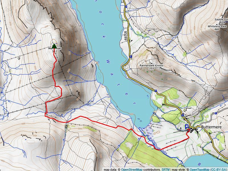
From Buttermere via the South Ridge (4) From the Buttermere Court Hotel (formely the Fish Hotel) walk along the gated lane towards the lake. In a little over 200 yards from the hotel go through a gate on the right onto a fenced bridleway which crosses the fields to Scale Bridge. Over the bridge turn right following the course of Buttermere Dubs towards Crummock Water. Cross Near Ruddy Beck by its large footbridge. As the bridleway approaches Far Ruddy Beck the path splits, take the left fork whcih crosses a footbridge over the beck near the bottom of Scales Wood. The path proceeds along towards Scale Force, take the left branch where the path forks again. The steep eastern slopes of Mellbreak falling to Crummock Water and the North Western fells across the lake dominate the view to the north. The path climbs a little more steeply as it approaches Scale Beck, rising to a handgate in the wall overlooking the beck. Descend from the handgate to the footbridge over Scale Beck and the viewing point for Scale Force. The waterfall, having a single drop of 170 feet, is the tallest in the Lake District and almost hidden away in its tree-lined gorge has long been a very popular tourist attraction. Continue west along the path above Black Beck for almost 500 yards before descending alongside a fence to cross the beck, go through the metal gate in the fence on the opposite bank and follow a path rising beside the fence to pass through another gate. Turn right on a gently rising path alongside the fence for 300 yards before taking one of two paths which climb up the col behind Scale Knott. It is worthwile to make a short diversion to visit the summit of Scale Knott which is fine viewpoint. From the col the path climbs the broad south ridge, which is quite steep in its middle section before the angle of the slope eases as it nears the summit of Mellbreak. Distance - 3.25 miles |
 |
|
From Loweswater via Low Ling Crag and the South Ridge (5) From the 'negative' signpost below St. Bartholemew's Church take the left hand lane to High Park. On passing the buildings of High Park seek a handgate in the wall on the right, it lies to the side of two mature trees, a green path rises from the gate to come alongside Green Wood. Crummock Water comes into view as the path crosses a brow, where the path splits take the left fork which leads directly down the slope to the lake shore. The path leads south alongside the lake beneath Mellbreak's steep eastern slopes for over a mile to Low Ling Crag, passing the Iron Stone on the way. Pause at Low Ling Crag, jutting out into the lake at the end of a narrow isthmus like an arrow head pointing across the lake towards Rannerdale Knotts and Whiteless Pike. Shortly after passing Low Ling Crag the path gradually climbs away from the lake to meet a footbridge over Scale Beck, don't cross the bridge but veer right and follow the course of Scale Beck. The path passes by the remnants of a large medieval settlement as it rises to join a bridleway path below a handgate. Continue on the bridleway as it runs well below the Scale Force ravine for just over half a mile to a metal gate in a fence where you join the route 4 path as it climbs beside the fence onto Mellbreak's south ridge. Distance - 4.25 miles |
 |
|
From Lanthwaite Wood via Pillar Rake (6) Take an early opportunity to climb up to a higher path on the slopes of Mellbreak from where a rising traverse is made towards a long scree shoot leading up to a row of four rocky aretes on the skyline. Near the top of the scree shoot, traverse right below the aretes, still climbing, to where a tilted grass rake behind the aretes comes into view. A faint path leads up to the bottom of the rake and becomes clearer as it rises along it , hugging the base of the crags on the right. There is little sense of exposure as the tops of the aretes on the left form a broken parapet of pillars, though they give dramatic views down the narrow gullies between them. At the end of the rake climb up an open bay to follow a very faint sheep trod leading south west which intercepts the plain ridge path on the wide depression between the twin summits. Distance - 2.5 miles |
| The Summit |
 |
| The southern and highest top is a gentle grassy dome studded with a few flat embedded rocks one of which supports the summit cairn. The northern heathery top is much more attractive, being narrower and better defined with a few rocky outcrops, it has two cairns the western one appears to be higher by a few inches. |
| The View |
| Although surrounded by higher fells the views from the two summits are quite similar. The North Western Fells in particular, up to a thousand feet higher than Mellbreak, are well seen from this mid-high point. The view of Loweswater from the north summit, cradled between its fells, is very fine but only very small sections of Crummock Water and Buttermere are visible from the cairn. Walk sixty yards to the east, in the direction of Grasmoor/Eel Crag, for a much better view of the twin lakes. The wide expanse of grass in the foreground detracts somewhat from the south summit's view in the vicinity of the cairn, a walk south east for a short distance is rewarded by a glorious view over the head of Crummock Water to Buttermere and its surrounding fells. |
|
Safe Descents In hill fog dismiss any thought of descending the eastern slopes directly to Crummock Water. From the main summit the broad south ridge is a much easier option to reach the lake's shore, although initially its steep grassy slope can be very slippery and tedious to descend in wet conditions. The direct descent to Loweswater from the north summit requires care, the path must be strictly adhered to, particulary in the vicinity of the big gully which splits the crags. The safest route of all is to descend west from the wide depression between the two summits where a clear path leads down to Mosedale. |
|