
| Ling Fell - Route One |
| Start - Brumston Bridge NY 184 292 | Distance - 1.25 miles | Ascent - 740 feet | Time - 50 minutes |
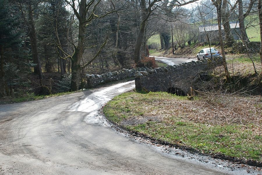 |
| Brumston Bridge, about half a mile east of Wythop Mill is the start of this walk. There is a parking area a few yards to the left of the bridge |
 |
| Past the private road to Burthwaite Farm a gate gives to the open fellside |
 |
| A Black Woodpecker decoy fixed to a telephone pole near the gate, used to discourage Great Spotted Woodpeckers from damaging the poles |
 |
| Looking back towards Sale Fell from the start of the climb |
 |
| It is possible to make a direct climb to the summit from the gate but it's easier to make use of a Corpse Road that runs along the northern slopes |
 |
| Looking back to the start. Distant views were very hazy today |
 |
| The Corpse Road |
 |
| Looking back towards Bassenthwaite Lake with Binsey on the left |
 |
| Near the highest point of the Corpse Road another track turns off left towards the summit |
 |
| The summit soon comes into view |
 |
| Looking across to the western ridge of Ling Fell |
 |
| The track veers to the left below the upper slopes |
 |
| Looking back westwards from the track |
 |
| The reason why the track veered away from the summit becomes clear when it crosses a level shoulder. It was used to access these old shooting butts. AW makes note of them in his diagram of this ascent |
 |
| Just beyond the butts a path turns off the track towards the summit |
 |
| Looking over to the Skiddaw group on the short climb to the summit |
 |
| The trig column soon comes into view |
 |
| And a little further to the east, on slightly lower ground, is a cairn |
 |
|
The summit of Ling Fell |
 |
| Binsey and part of Bassentwaite Lake from the summit |
 |
| Sale Fell to the north east |
 |
| The Skiddaw group of fells |
 |
| Broom Fell to the south east |
 |
| Grisedale Pike, Eel Crag, Hopegill Head, Grasmoor and Whiteside on the horizon |
|