 |
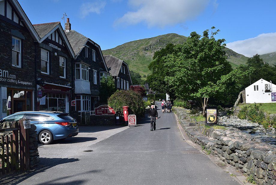
| The walk starts along the village road on the south bank of Glenridding Beck. The road passes Glenridding Public Hall and Eagle Farm, bear right at a fork onto a riverside bridle-track which leads past Gillside campsite |
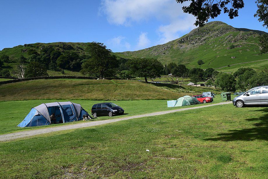 |
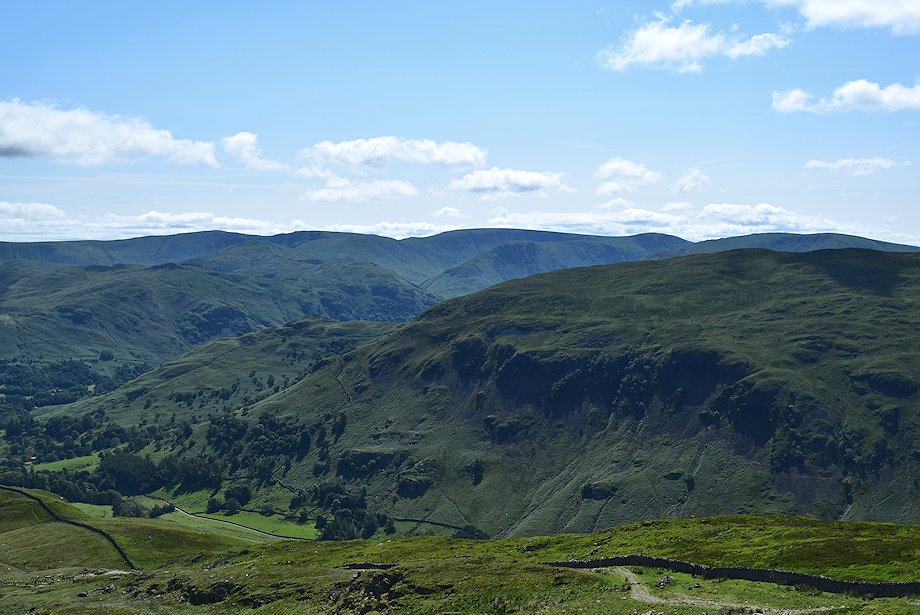
| Birkhouse Moor from the Gillside campsite |
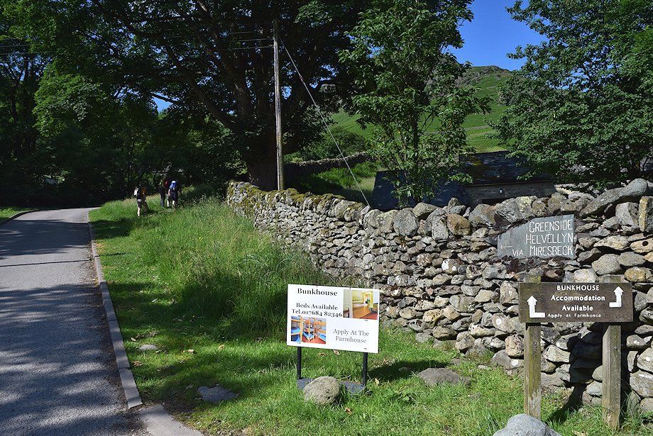 |
| The bridle-track emerges onto the Greenside Road ~ Miresbeck lane where a sign indicates the start of the Helvellyn via the Mires Beck path |
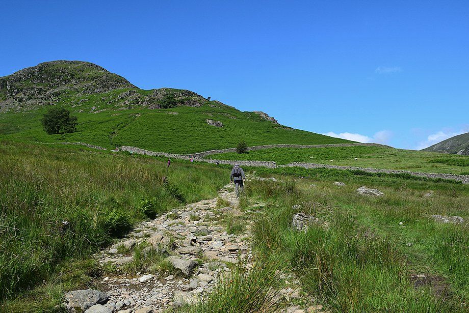 |
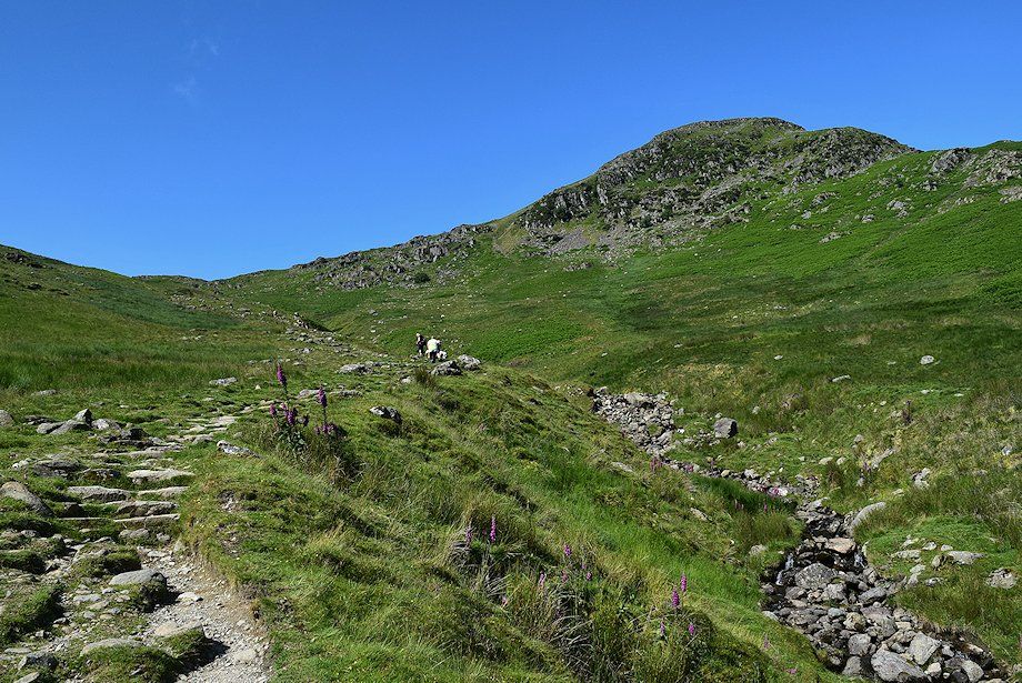
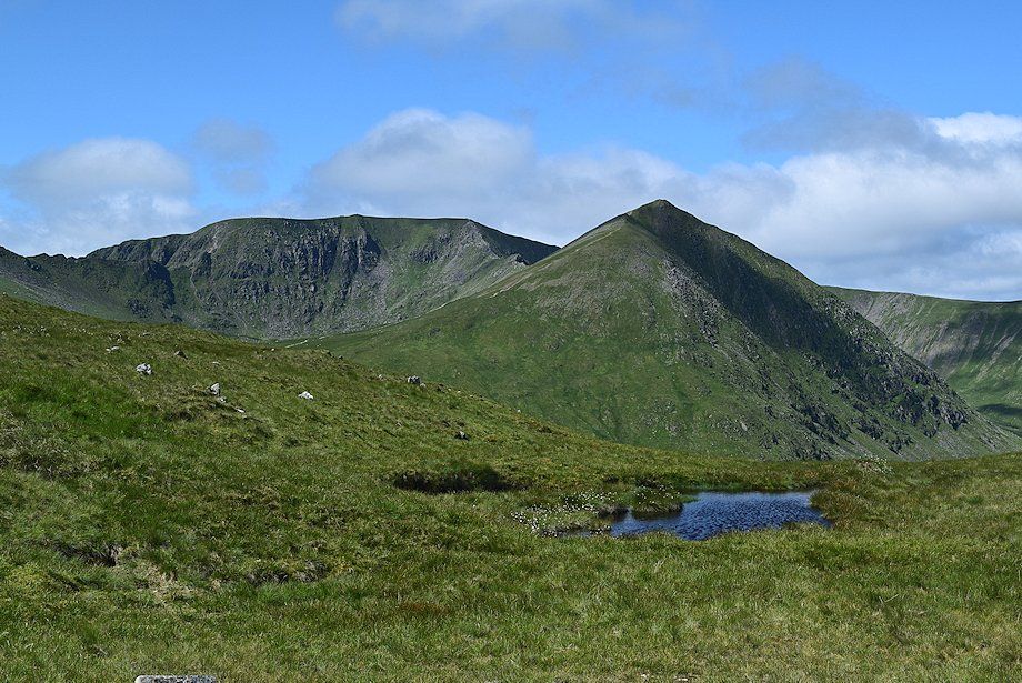
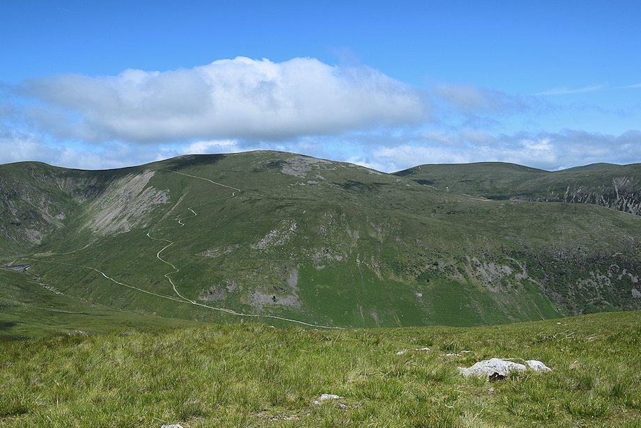
| The north east ridge of Birkhouse Moor from the Mires Beck path |
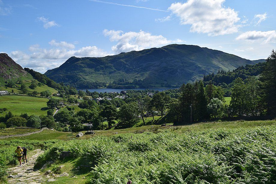 |
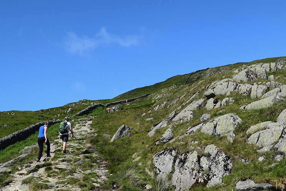
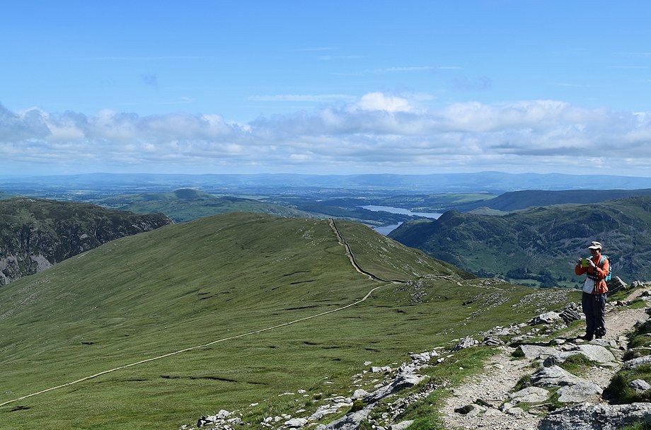
| Looking back towards Glenridding and Place Fell from the Mires Beck path |
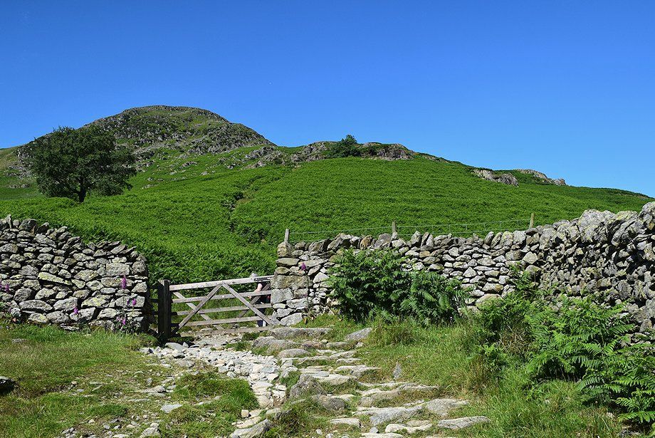 |
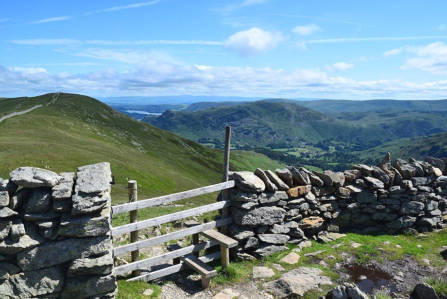
| A gate in the intake wall gives access to the open fellside, the path turns left through the gate into Little Cove |
 |
| A hundred yards above the gate the path descends to ford Mires Beck in Little Cove |
 |
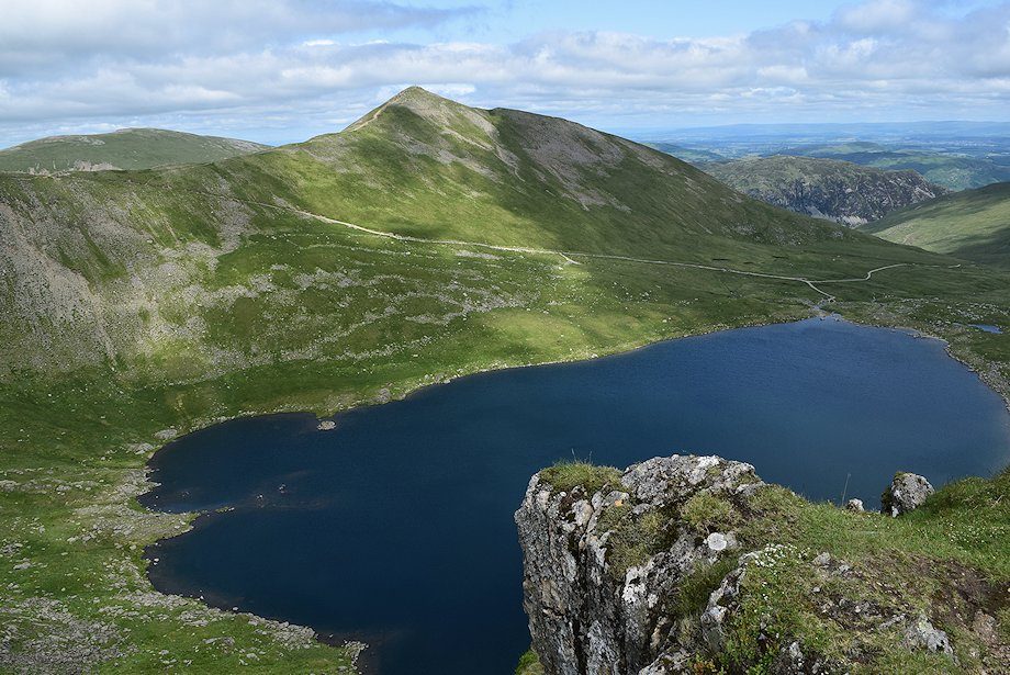
| Looking back to Glenridding Dodd from the ford over Mires Beck |
 |
| The path continues along the eastern side of Mires Beck towards the head of Little Cove |
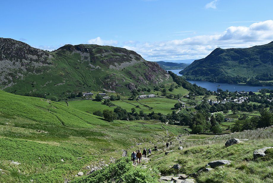 |
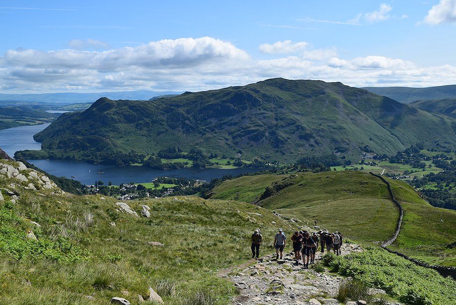
| Looking back to Glenridding and Ullswater |
 |
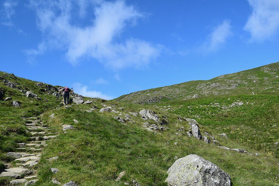
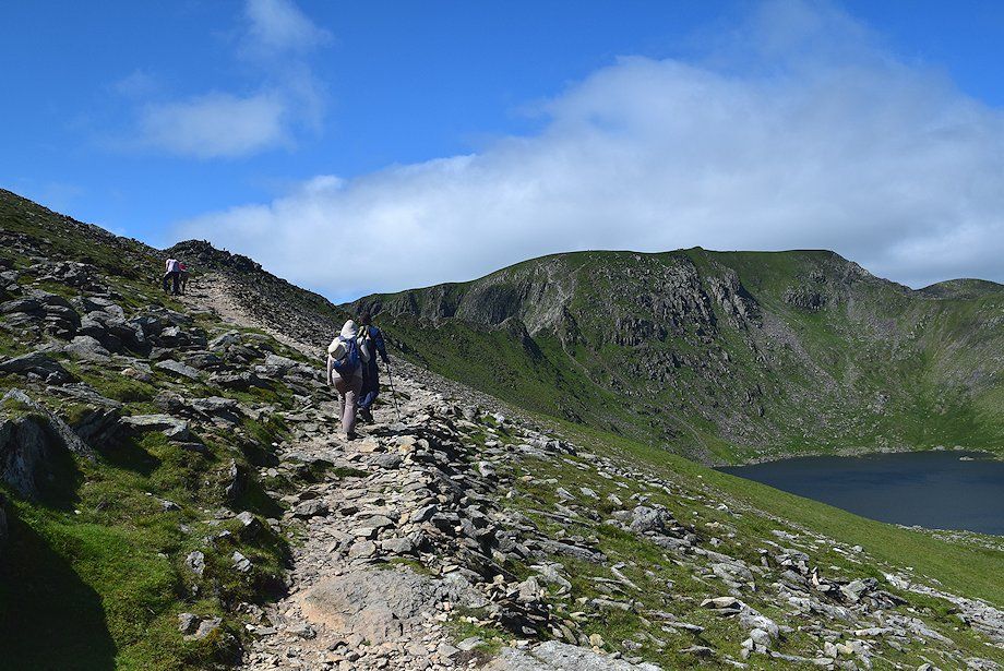
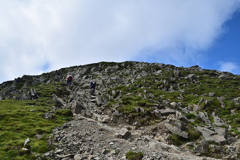
| The path has been stone-pitched for much of its length through Little Cove to reduce erosion. Being the quickest way to Striding Edge and the summit of Helvellyn from Glenridding it's very popular and heavily used |
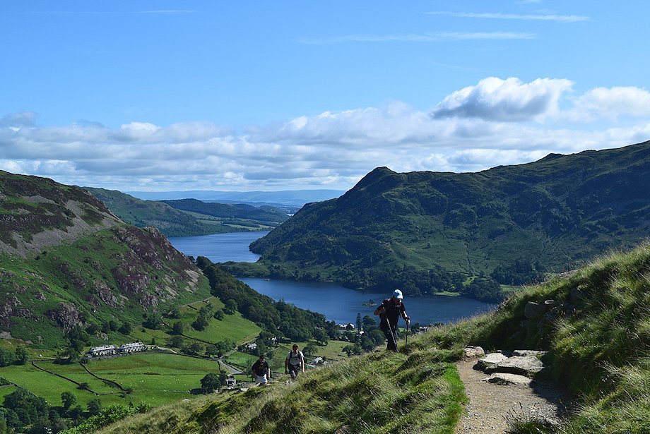 |
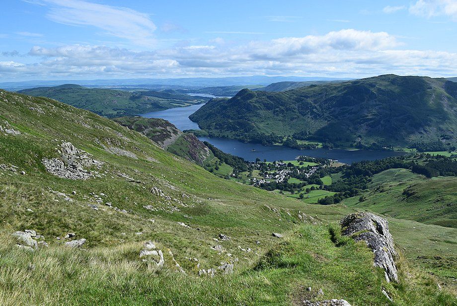
| Looking back towards Ullswater |
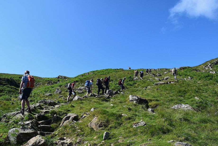 |
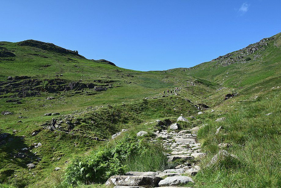
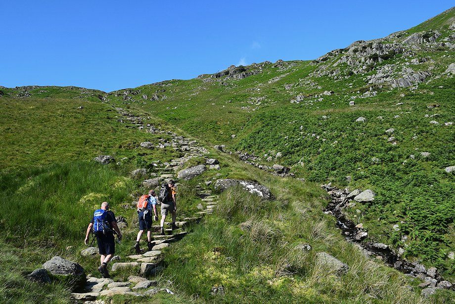
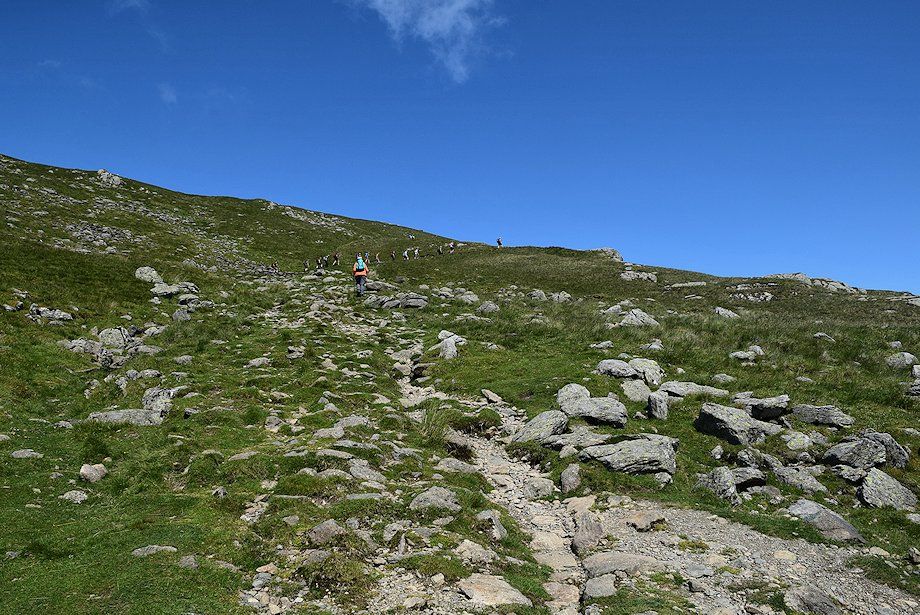
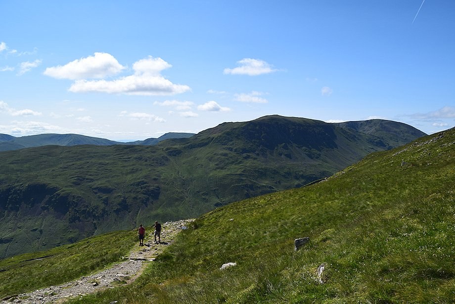
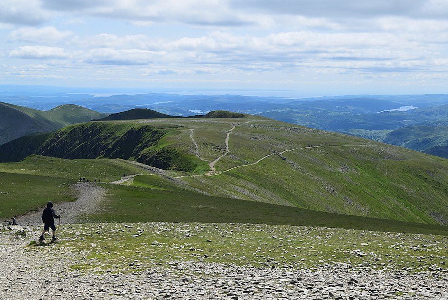
| High on the Mires Beck path, walkers bound for Striding Edge |
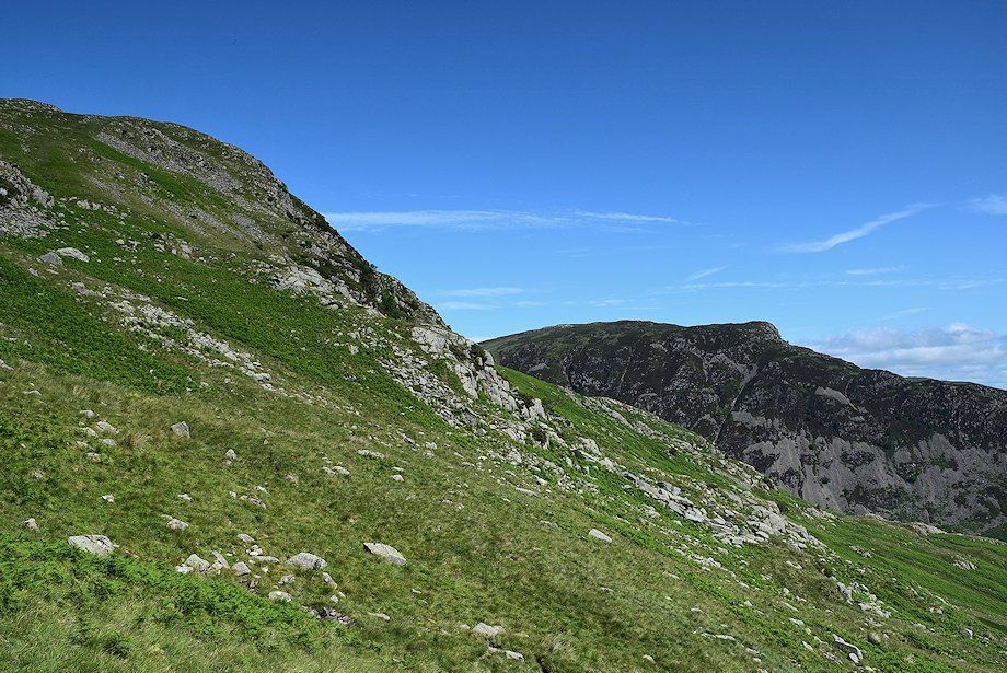 |
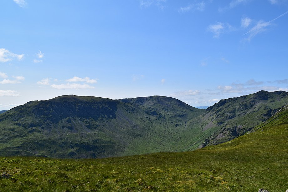
| Sheffield Pike across the north east ridge of Birkhouse Moor |
 |
| Approaching the head of Little Cove |
 |
| Looking over towards St. Sunday Crag and Fairfield |
 |
| At the head of Little Cove the path turns west to follow the course of a wall |
 |
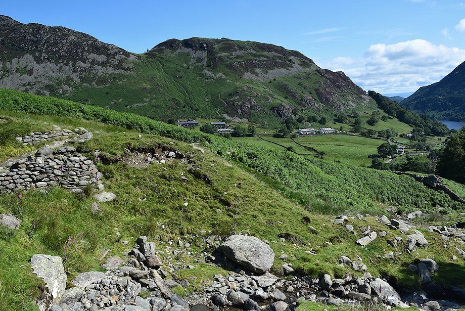
| Looking back to Place Fell |
 |
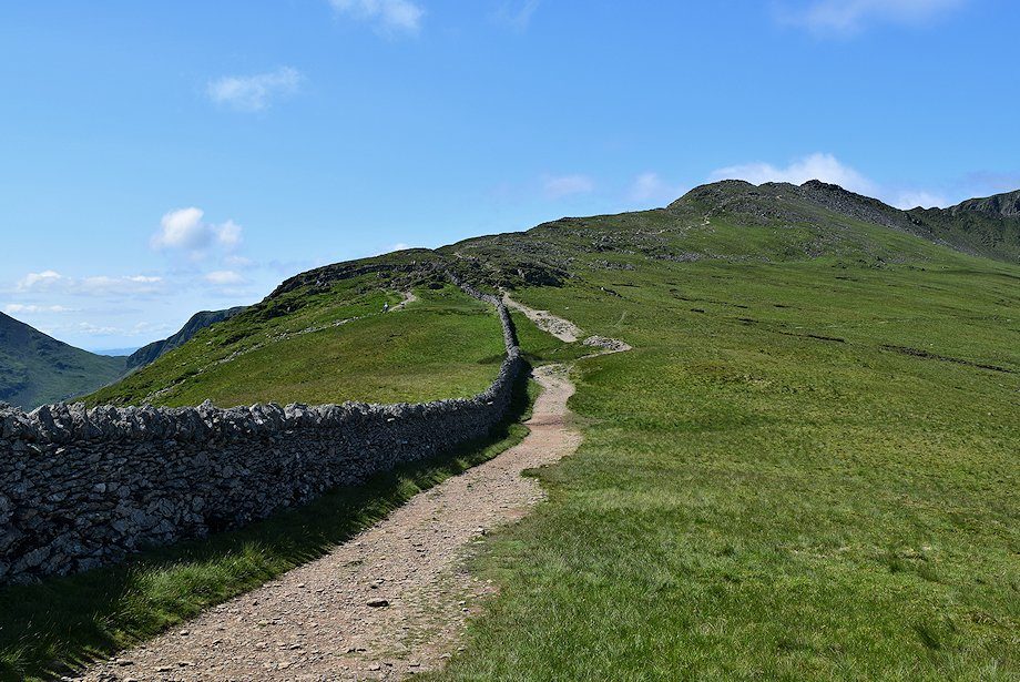
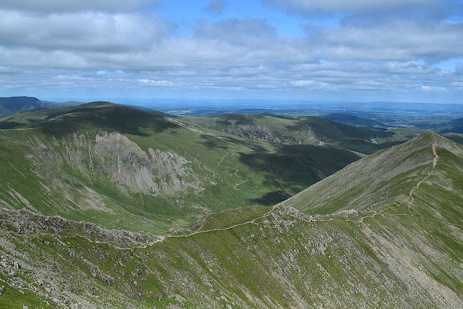
| Higher up, the path veers away from the wall and climbs towards the summit ridge of Birkhouse Moor |
 |
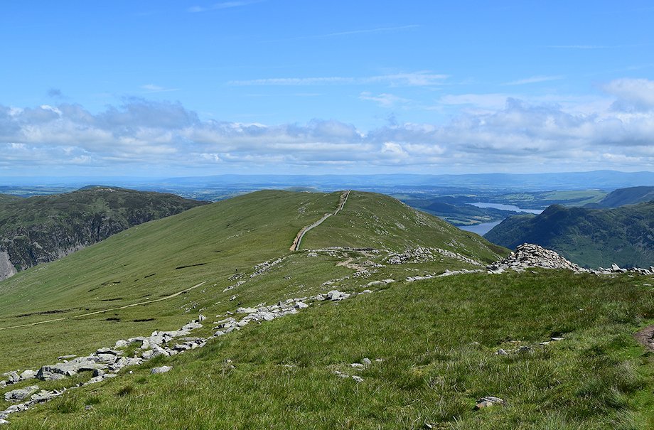
| Glenridding and Ullswater |
 |
| Looking back to the Far Eastern Fells of High Raise, Rampsgill Head, High Street, Thornthwaite Crag, and Caudale Moor on the horizon |
 |
| Looking back towards St. Sunday Crag and Fairfield on the right with the summits of Caudale Moor and Red Screes on the left |
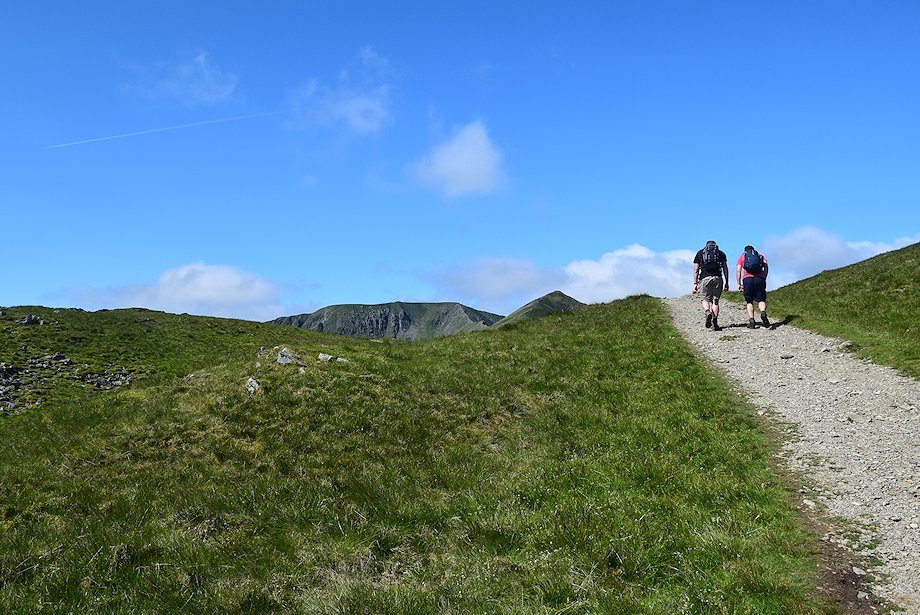 |
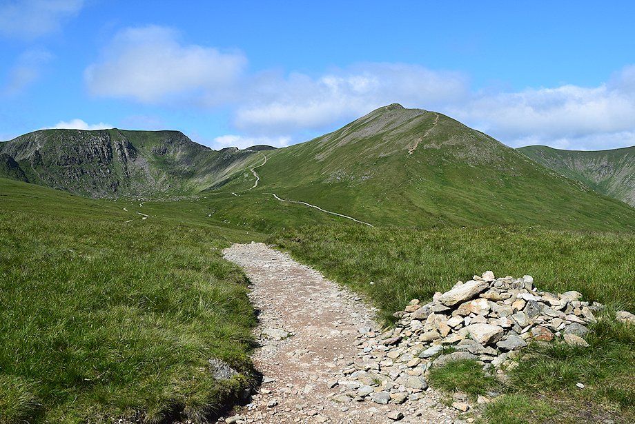
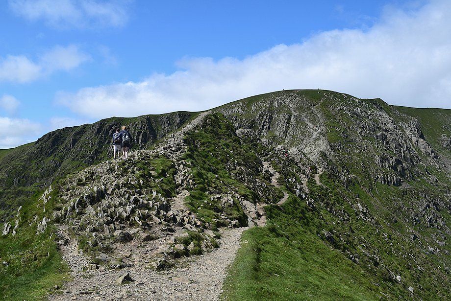
| The summits of Helvellyn and Catstycam come into view as the path approaches the summit ridge of Birkhouse moor |
 |
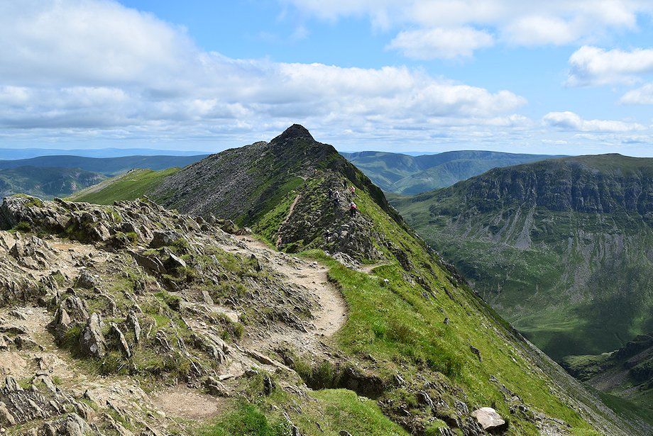
| Striding Edge comes into view |
 |
| Helvellyn and Catstycam |
 |
| Looking over towards White Side, Raise and Stybarrow Dodd |
 |
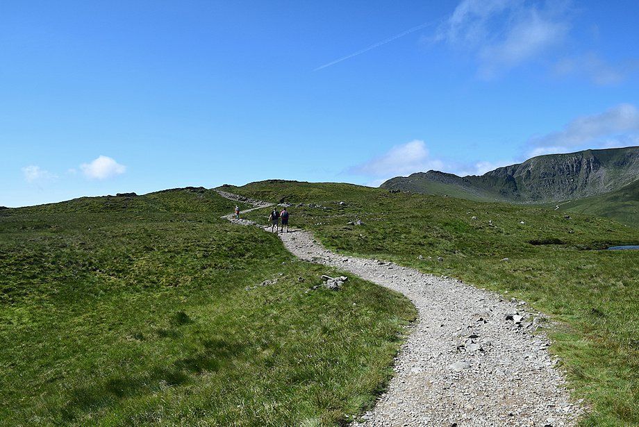
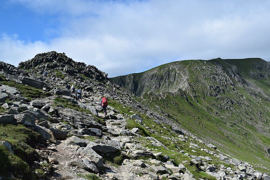
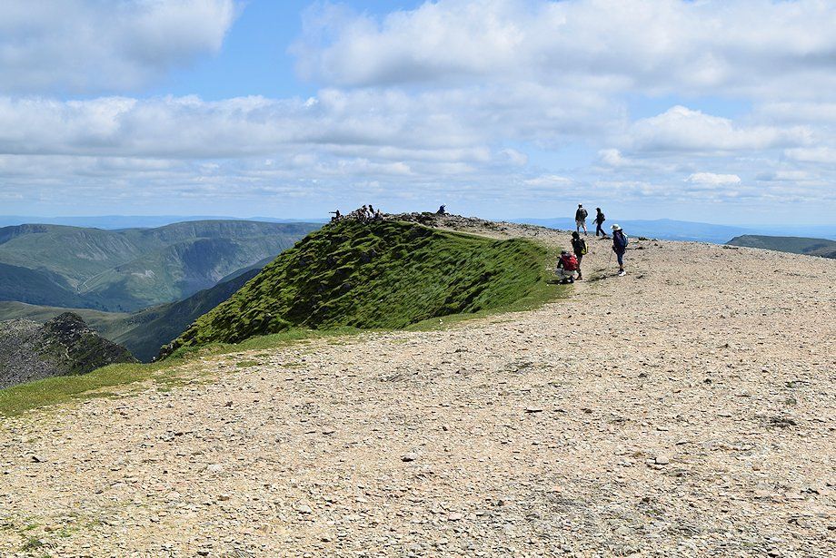
| Approaching the summit of Birkhouse Moor |
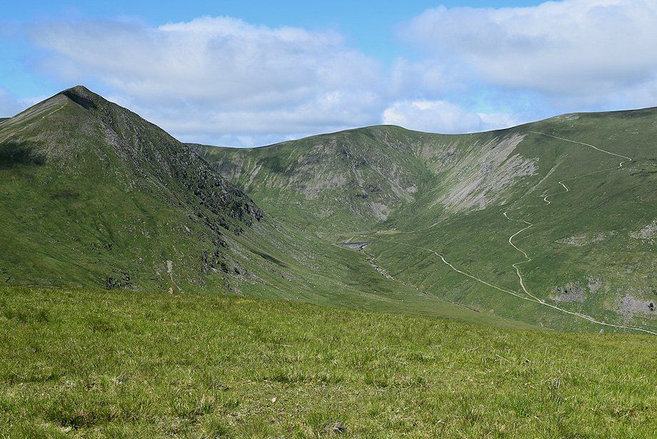 |
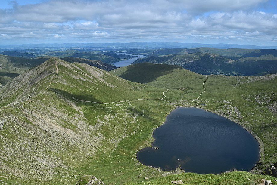
| Looking over to the breached Keppel Cove dams |
 |
| Striding Edge, Helvellyn and Catstycam from the summit of Birkhouse Moor |
 |
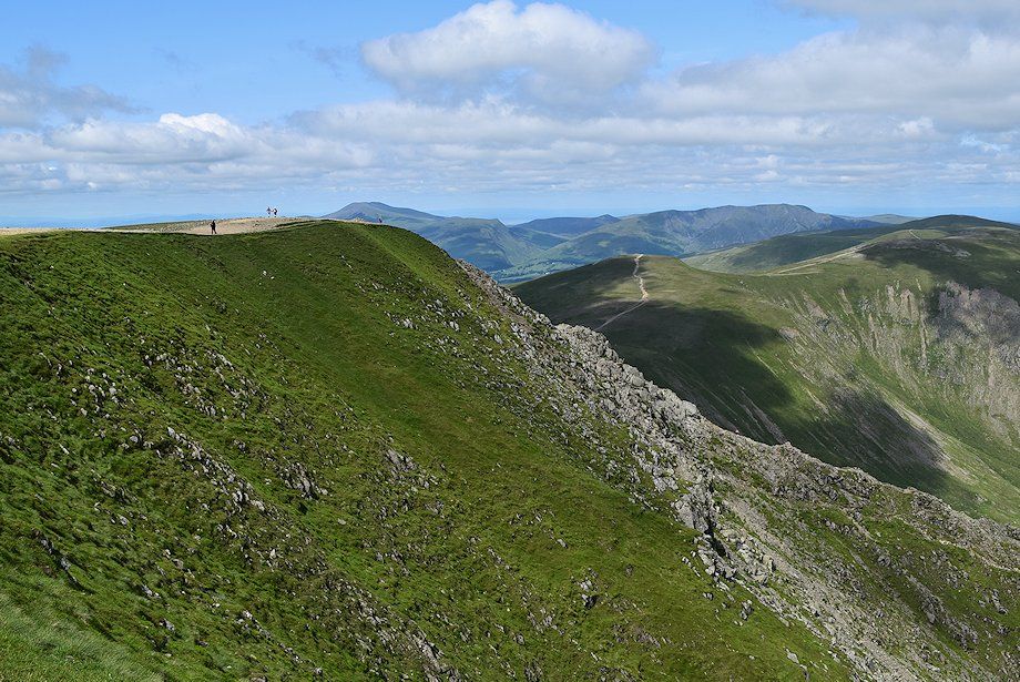
| Looking back along the summit ridge path of Birkhouse Moor |
 |
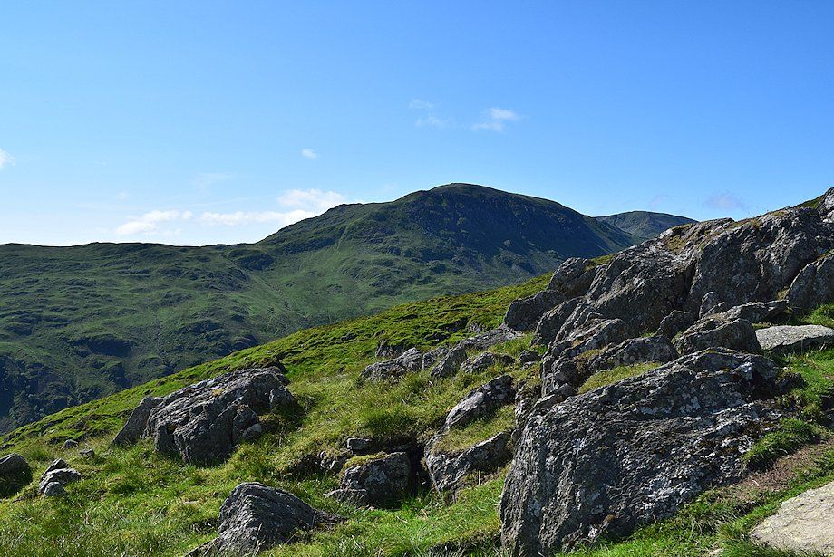
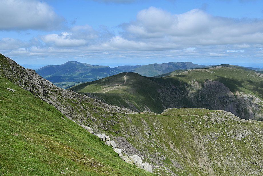
| White Side, Raise, Stybarrow Dodd and Hart Side from the summit of Birkhouse Moor |
 |
| St. Sunday Crag, Fairfield and Dollywaggon Pike from the summit of Birkhouse Moor |
 |
| Approaching the Hole-in-the-Wall where the path from Grisedale joins the Glenridding path |
 |
| Near the Hole-in-the-Wall a marker cairn indicates the start of a path which descends towards Red Tarn to join the path to Swirral Edge |
 |
| Place Fell from the Hole-in-the-Wall, the summit of Birkhouse Moor on the left |
 |
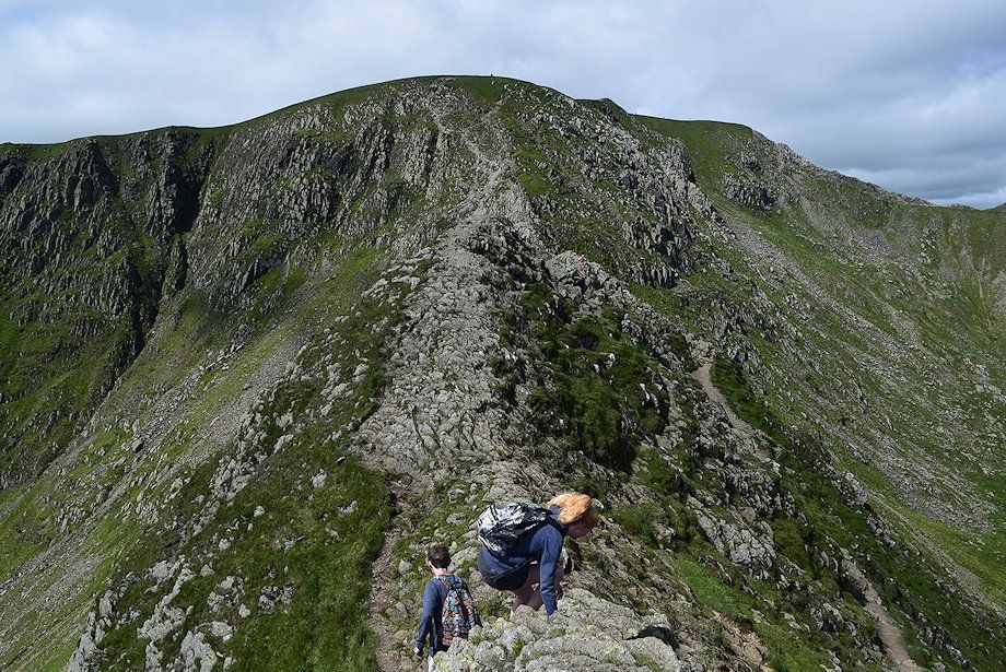
| From the Hole-in-the-Wall the path climbs steadily across the northern slopes of Bleaberry Crag and Low Spying How to reach the start of Striding Edge at High Spying How. A minor path breaks off to the left after 500 yards to follow the crest of the ridge over Low Spying How, most walkers prefer to stay with the main path |
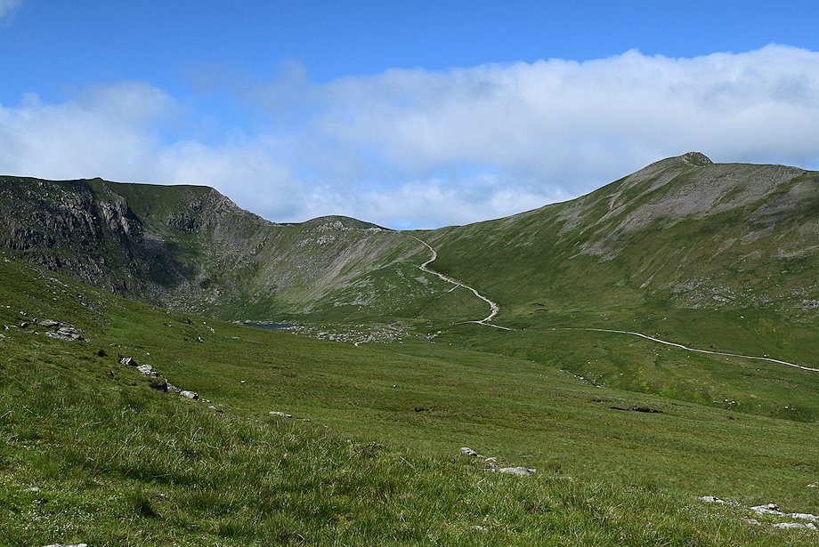 |
| Red Tarn comes into view |
 |
| Looking back to Birkhouse Moor |
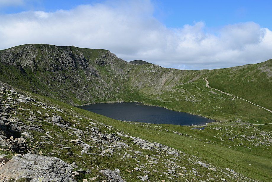 |
| Red Tarn and Swirral Edge from the slopes of Low Spying How |
 |
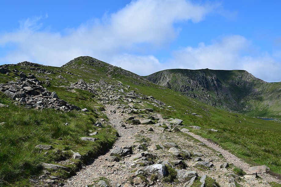
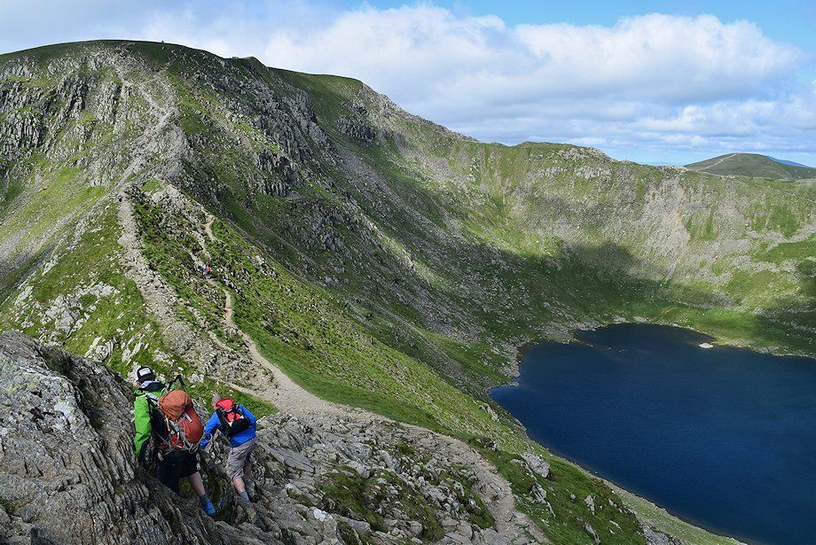
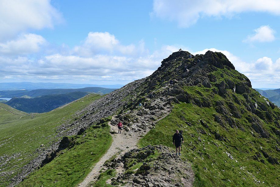
| High Spying How, the start of Striding Edge, comes into view |
 |
| Looking back from the slopes of Low Spying How |
 |
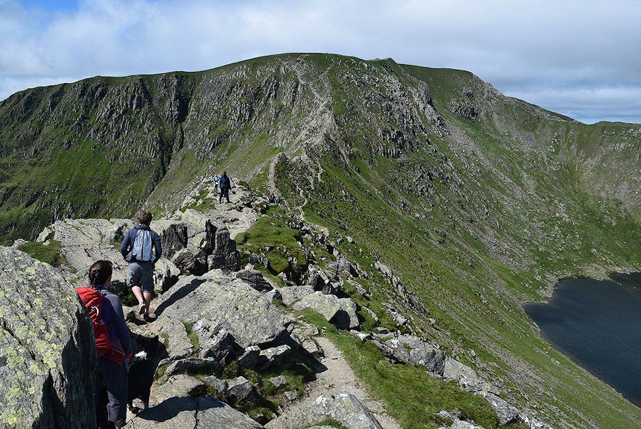
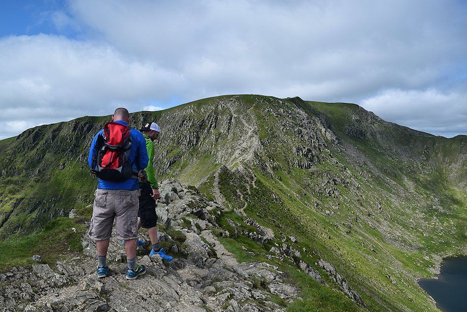
| Approaching High Spying How. The path divides near here and a decision must be taken by more cautious walkers as to whether or not to take the lower path which avoids the crest of Striding Edge |
 |
| Dollywaggon Pike from the climb to High Spying How |
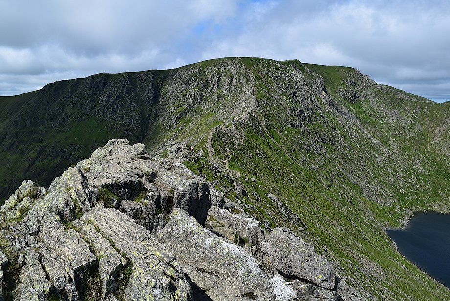 |
| Helvellyn and Striding Edge from High Spying How |
 |
| St. Sunday Crag, Red Screes and Fairfield from High Spying How |
 |
| Continuing on from High Spying How involves a short descent over flat topped rocks, passing the Dixon Memorial, to reach a level section of the ridge |
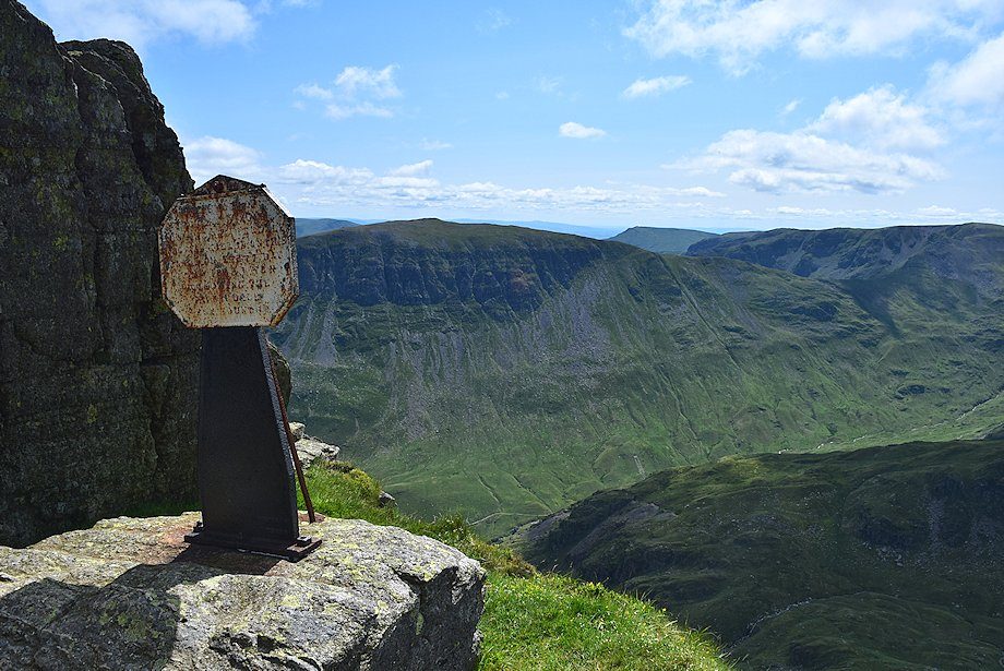 |
| The Dixon Memorial overlooking Nethermost Cove. It is inscribed - In memory of Robert Dixon of Rooking, Patterdale who was killed on this spot on the 27th day of November 1858 following the Patterdale Foxhounds |
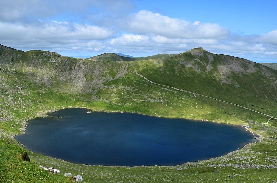 |
| Red Tarn from the Dixon Memorial |
 |
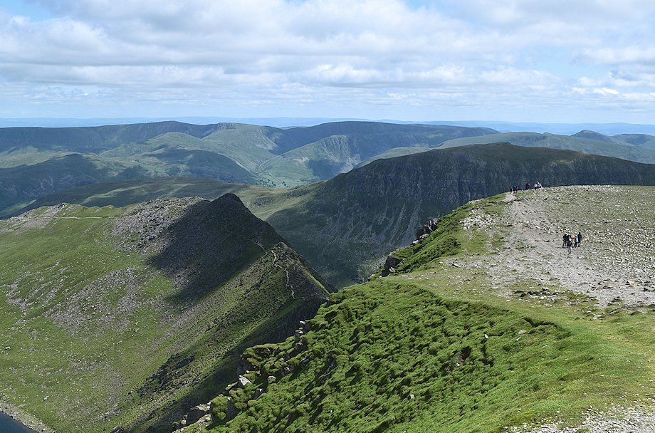
| Looking back to High Spying How |
 |
| The level section of the ridge |
 |
| The short level section ends above a steep rock face which is avoided by descending its northern side to join the lower path |
 |
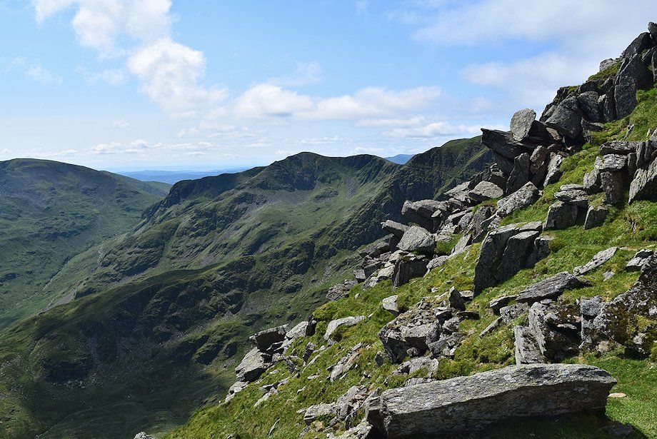
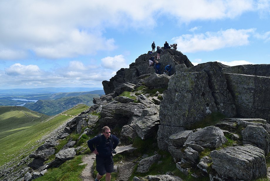
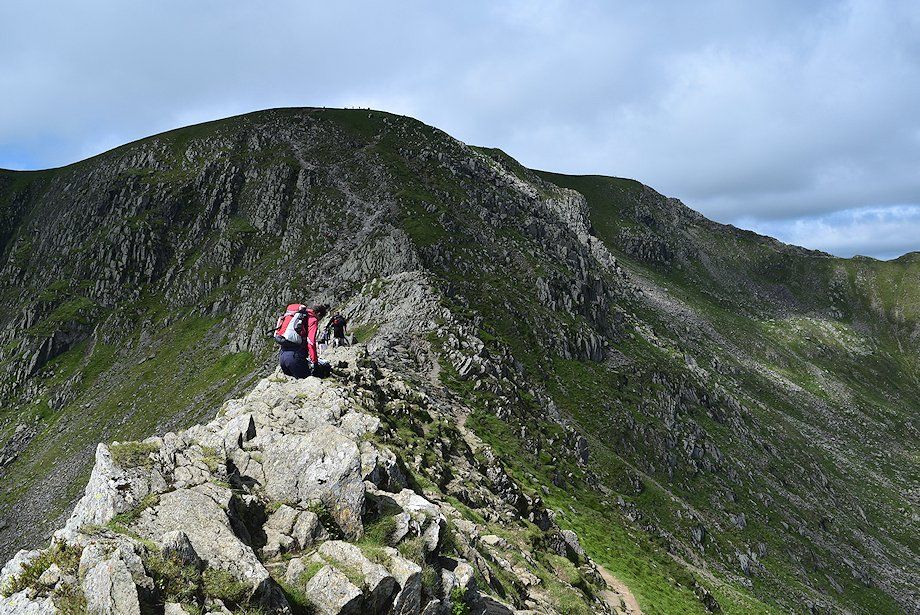
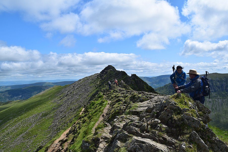
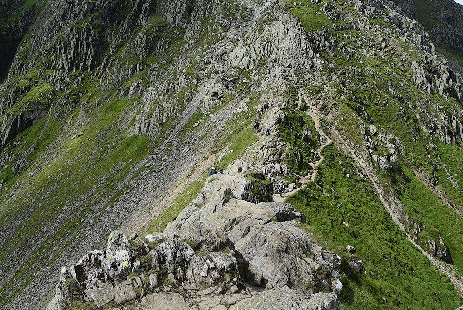
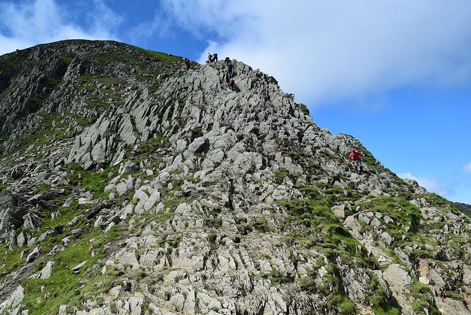
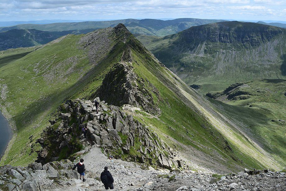
| The crest path continues on over four small rock towers which form the narrowest part of the ridge. The lower path avoids them on the right, the two paths re-unite on a wide col below a fifth and final tower |
 |
| Looking back along the ridge from the ascent of the first tower |
 |
| Descending the first tower |
 |
| Ascending the third tower |
 |
| Helvellyn from the fourth tower |
 |
| Looking back along Striding Edge from the fourth tower |
 |
| Descending the fourth tower to the col below the final tower |
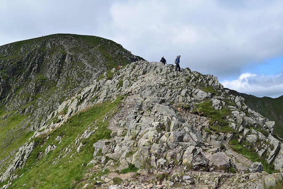 |
| The final tower from the col, the lower path joins the crest path at this point |
 |
| Looking back from the final tower |
 |
| St. Sunday Crag and Fairfield across Nethermost Cove from the top of the final tower |
 |
| Catstycam and Red Tarn from the top of the final tower |
 |
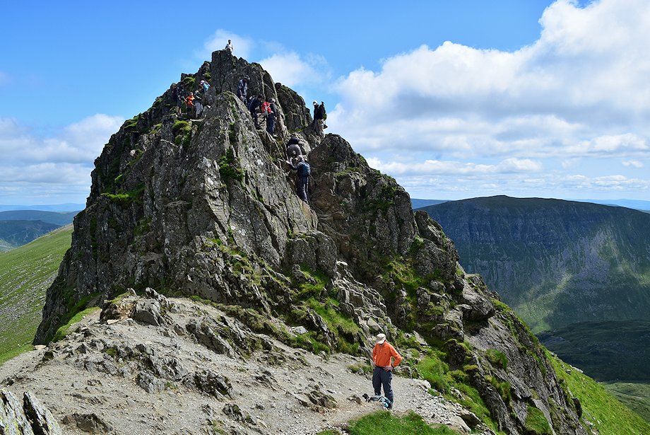
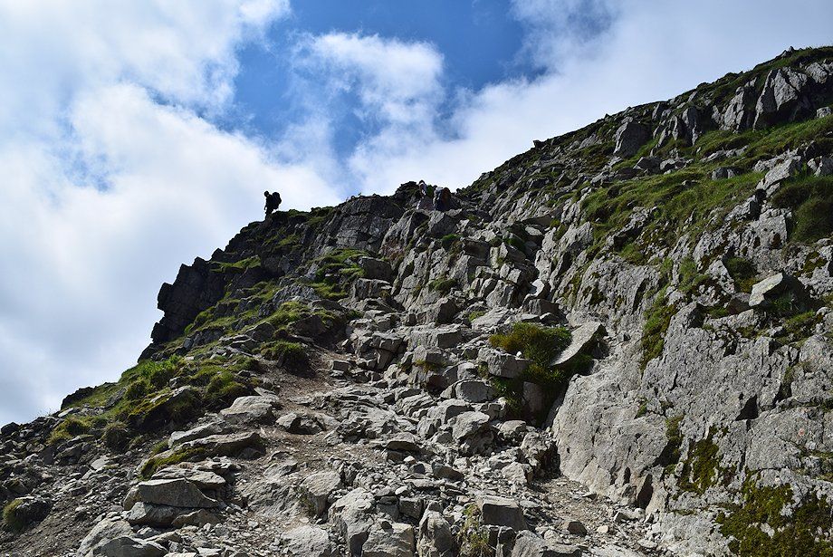
| The descent of the final tower via a 25 foot high chimney groove which marks the end of Striding Edge is the most challenging part of the traverse |
 |
| Looking back to the final tower |
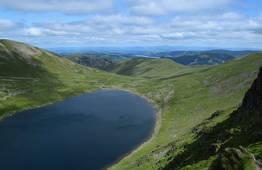 |
| Red Tarn from the end of Striding edge |
 |
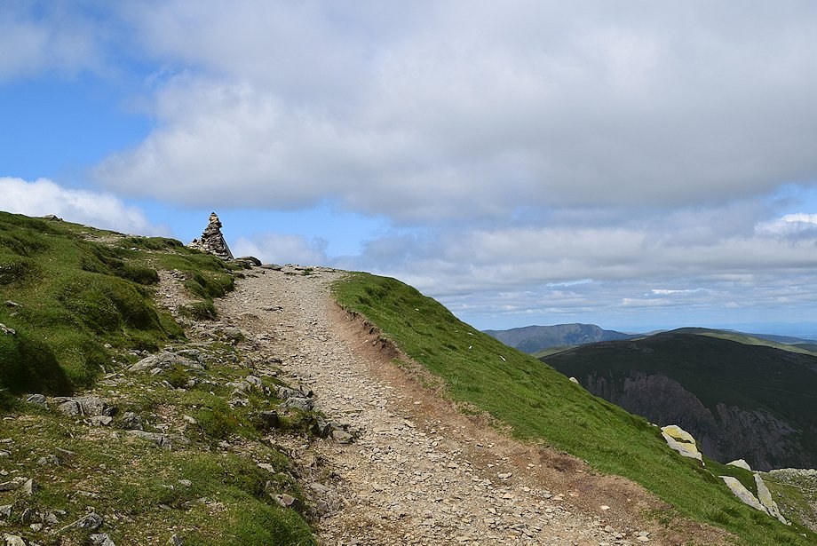
| All that remains is a climb of about 400 feet of the east face of Helvellyn to gain the summit ridge near the Gough Memorial. The climb up the prominent rock ridge, known as The Castle is much easier than it appears from below. Avoid the eroded scree slope to the left |
 |
| Above The Castle the path slants half left above the crags overlooking Nethermost Cove |
 |
| Looking back to the top of The Castle |
 |
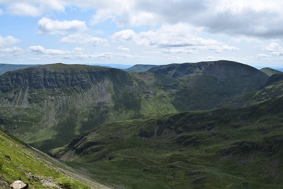
| Looking across Nethermost Cove towards Fairfield, Great Rigg and Nethermost Pike |
 |
| About halfway up the slope the path divides, the right fork takes a more direct line to the Gough Memorial |
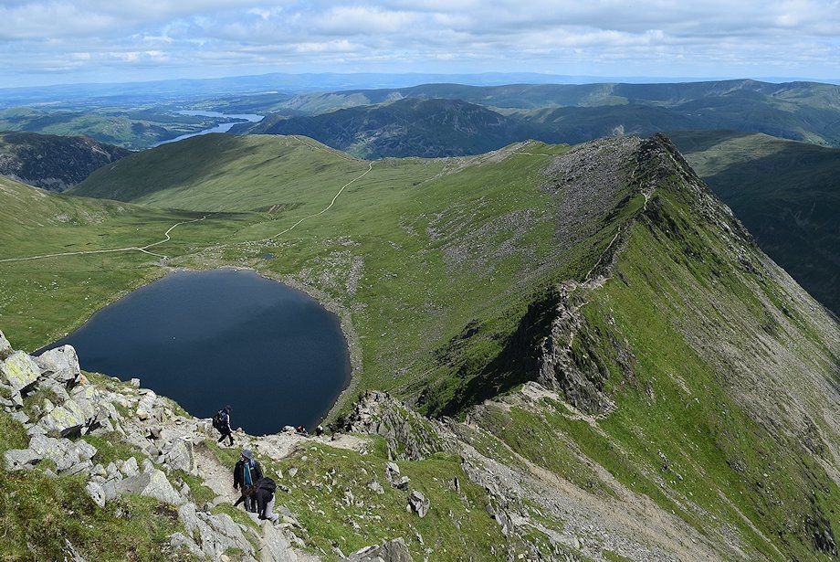 |
| Red Tarn and Striding Edge |
 |
| The Coniston fells appear over the col between Helvellyn and Nethermost Pike |
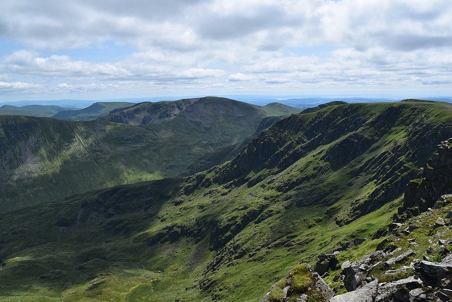 |
| Looking across Nethermost Cove |
 |
| Approaching the Gough Memorial |
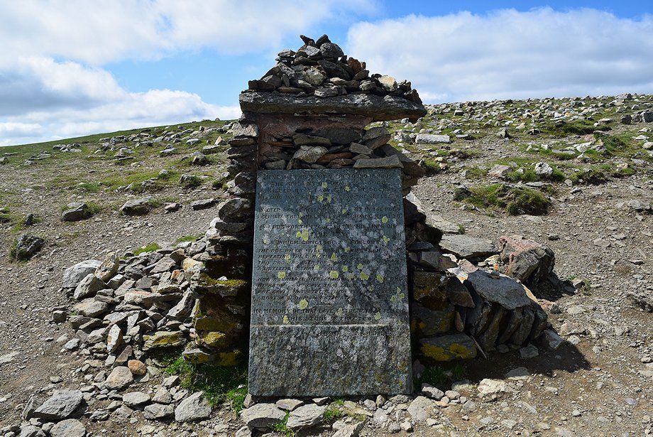 |
| At the time of this walk the memorial stone had been dislodged from its cairn. It was fully restored a few days later by a Friends of the Lake District volunteer work party |
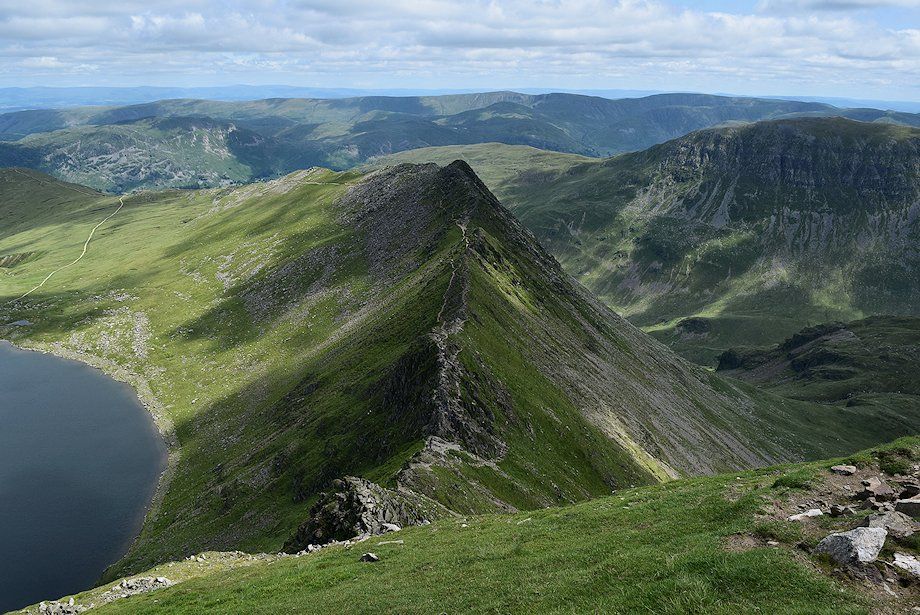 |
| Striding Edge from the Gough Memorial |
 |
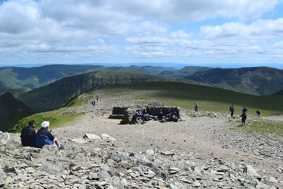
| The summit of Helvellyn from the Gough Memorial. The path follows the edge of the escarpment, passing the wall shelter on the way to the summit knoll |
 |
| Swirral Edge from the path along the escarpment |
 |
| Ullswater from the escarpment |
 |
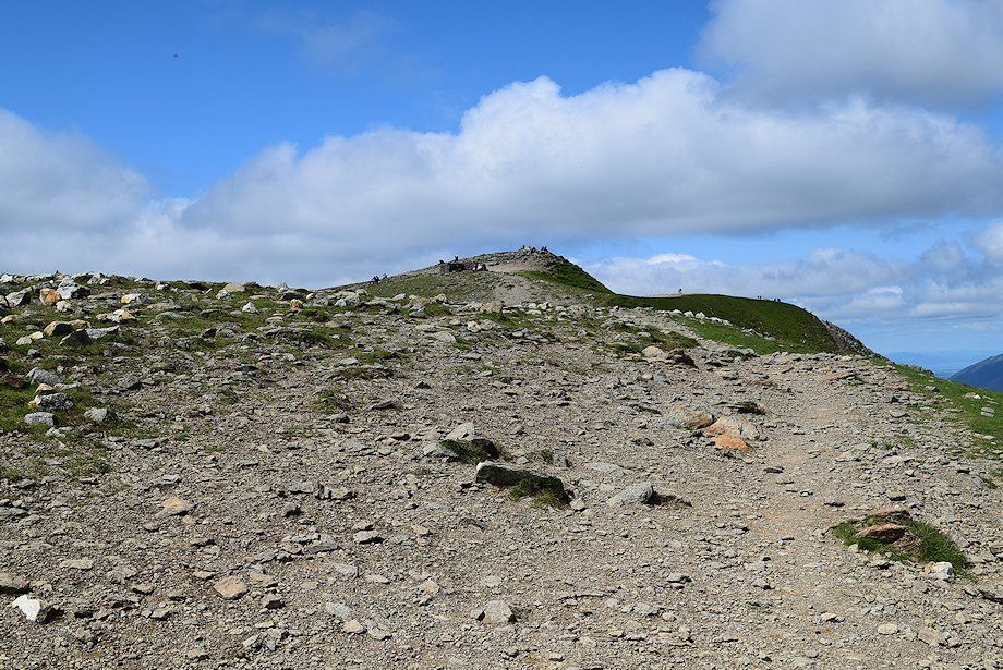
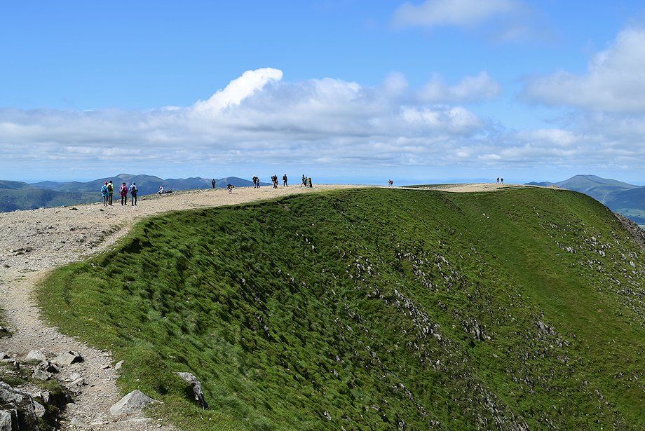
| The summit cairn on Helvellyn |
 |
| The trig column lies a hundred yards to the north west |
 |
| Skiddaw and Blencathra on the horizon over Swirral Edge from the summit of Helvellyn |
 |
| Raise, Stybarrow Dodd, and Great Dodd over Swirral Edge |
 |
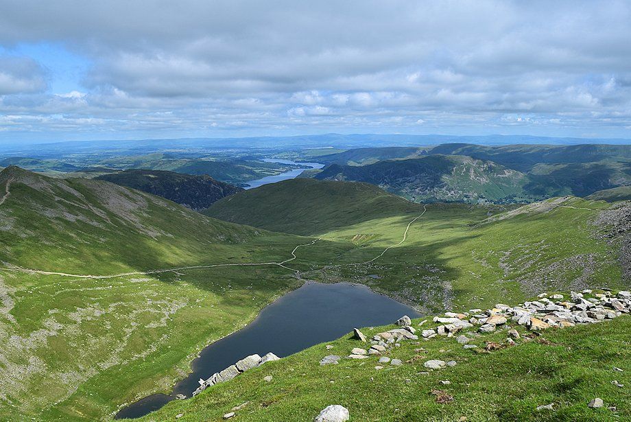
| Ullswater and Red Tarn from the summit of Helvellyn |
 |
| Striding Edge from the summit of Helvellyn |
 |
| The wind shelter on the summit of Helvellyn |
 |
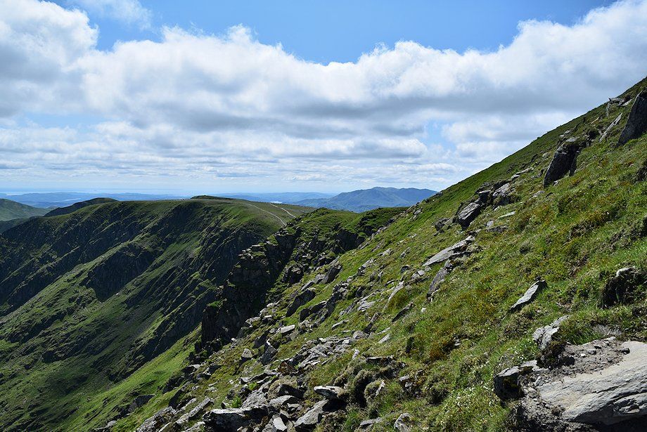
| The connecting ridge to Nethermost Pike and Dollywaggon Pike |
 |
| Looking south-southwest, the summits of Wetherlam, Coniston Old Man, Brim Fell, Great Carrs, Grey Friar, Pike o' Blisco, Black Combe, Crinkle Crags and Bowfell form the skyline |
 |
| Looking north-northwest, the summits of Crinkle Crags, Bowfell, Esk Pike, Scafell, Scafell Pike, Great End, Lingmell, Glaramara, Yewbarrow, Great Gable, Green Gable, Kirk Fell, and Red Pike form the skyline |
 |
| Catstycam and Ullswater from the trig column |
 |
| The North Western Fells from the trig column |
 |
| The summit of Helvellyn from the trig column |
