 |
| Browncove Crags from Swirls. The route climbs the bracken clad slope above the car park by a series of zigzags and then follows the edge of the crags to Helvellyn Lower Man and the summit ridge |
 |
| At the back of the car park a footbridge over the stream ( Helvellyn Gill ) leads to a handgate and the path to Stanah and Helvellyn |
 |
| A little further on the path to Stanah and Sticks Pass turns off to the left. The route to Helvellyn continues on across a small footbridge |
 |
| Looking back to Raven Crag above Thirlmere |
 |
| The path re-crosses Helvellyn Gill to reach the open fellside via gates in the intake walls |
 |
| The first of a long series of zigzags up the very steep lower slope. Higher up the path has been stone pitched for much of its length which, together with some re-alignment, has made this ascent much easier |
 |
| Thirlmere and Skiddaw from the lower slope |
 |
| A little higher up looking back to the start of the climb. The retrospective views are a good excuse for frequent rests, although the stone pitching does make this quite an easy ascent despite its initial steepness |
 |
| Higher again and the North Western Fells begin to appear over the low central ridge above Thirlmere |
 |
| From the same position looking to the Northern Fells; Lonscale Fell, Great Calva and Blencathra provide the backdrop here |
 |
| Bull Crag above Thirlmere and Great Gable centre right |
 |
| The gradient eases as the path passes by a ruin. It is not marked on the map and AW makes no note of it on his diagram of this ascent although it does appear in the revised edition |
 |
| Looking back to Skiddaw from the ruin |
 |
| From the same position, across the central ridge to Great Gable and Pillar with Dale Head on the right. Clouds are beginning to envelop Pillar. The weather forecast had predicted heavy thunderstorms to the north of the Lake District today and, although it remained dry, conditions began to deteriorate very rapidly |
 |
| The path continues up a broad shoulder towards a steeper climb alongside Browncove Crags |
 |
| High on the path alongside the edge of Browncove Crags looking down to Hawes How island |
 |
| The stone pitching has greatly eased the ascent of the scree slope along the edge and has helped to make this the most popular route up Helvellyn from the Thirlmere side |
 |
| Looking back from near the top of Browncove Crags |
 |
| Blencathra from Browncove Crags |
 |
| Helvellyn Lower Man from the top of Browncove Crags. The ridge path, now almost as wide as a road, by-passes it but it is well worth making the short detour to reach its summit |
 |
| Looking back to the top of Browncove Crags from the path along the ridge |
 |
| The summit ridge from below Helvellyn Lower Man, the cairn on the left stands above Swirral Edge |
 |
| Browncove Crags from the summit of Helvellyn Lower Man |
 |
| Skiddaw from Helvellyn Lower Man |
 |
| Ullswater and Catstycam from Helvellyn Lower Man |
 |
| Looking across Brown Cove to Helvellyn's summit plateau, part of Striding Edge can be seen beyond Swirral Edge |
 |
| Catstycam and Swirral Edge from the path to the summit |
 |
| Looking back to Helvellyn Lower Man |
 |
| The marker cairn at the top of Swirral Edge |
 |
| Striding Edge from the top of Swirral Edge |
 |
| Looking down Swirral Edge to Catstycam |
 |
| Red Tarn from the top of Swirral Edge |
 |
| Approaching the summit of Helvellyn, the trig column on the right, the highest point in the centre with the top of Striding Edge on the left marked by the Gough memorial |
 |
| The top section of Swirral Edge from the summit |
 |
| Raise across Swirral Edge |
 |
| Catstycam from the summit |
 |
| Ullswater and Red Tarn |
 |
| Striding Edge |
 |
| St.Sunday Crag across the top of Striding Edge |
 |
| The summit shelter |
 |
| Looking along the ridge to the flat summit of Nethermost Pike in the middle distance backed by Dollywaggon Pike and High Crag |
 |
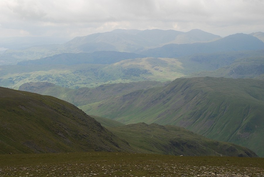
| The Coniston fells on the horizon |
 |
| Great Gable almost covered by the increasing cloud formations |
 |
| The High Stile ridge left centre above Honister Crag and Dale Head |


