
| Caw - Route One |
| Start - Hawk Bridge SD 239 919 | Distance - 3.4 miles | Ascent - 1,525 feet | Time - 2 hours : 10 minutes |
 |
| The Forestry Commission car park at Hawk Bridge is the starting point for this walk. The Hawk is a small hill above the car park which is the site of an ancient British Settlement |
 |
| From the end of the car park a woodland track enters the Broughton Moor Plantation following the course of Appletree Worth Beck |
 |
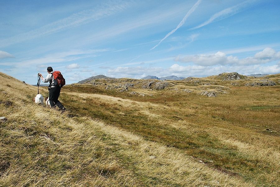
| Half a mile from the car park we leave the forest track and follow an indistinct path through the trees which climbs over the low ridge between The Hawk and The Knott |
 |
| Looking up to the summit ridge of The Knott |
 |
| The summit of Caw comes into view as the path begins to descend into the Lickle Valley |
 |
| The path joins a forestry road which leads up towards the head of the Lickle Valley |
 |
| Three quarters of a mile along the road the rocky summit of Pikes comes into view. At this point a small cairn indicates the start of a path which drops down to cross the River Lickle by a small clapper bridge to join a bridleway on its west bank which comes up from Stephenson Ground |
 |
| We continue on the foresty road with the summit of White Pike dominating the view ahead |
 |
| Looking back along the Lickle Valley |
 |
| The forestry road ends at a stile which gives access to the open fellside |
 |
| The path descends slightly and crosses Natty Bridge which spans the deep ravine of Yewry Syke |
 |
| From Yewry Syke the path rises to cross the River Lickle, at that point just a small stream, and joins the bridleway on its west bank |
 |
| Looking across the steep eastern slopes of Caw, the subsidiary top of Tail Crag on the left, the summit of Caw in the centre and Pikes on the right |
 |
| Looking back to Lag Bank and The Knott, Natty Bridge can be seen in the centre of the photo |
 |
| The bridleway leads over the head of the valley and eventually joins the Walna Scar Road as it rises from the Duddon Valley |
 |
| The summit of White Pike over the head of the Lickle Valley |
 |
| We left the bridleway where it began to skirt Caw Moss and began to contour around the north eastern slopes of Caw towards Green Pikes |
 |
| The path is very indistinct where it follows the edge of Yaud Mire |
 |
| Looking across Dawson Pike to White Pike |
 |
| The summits of Harter Fell, Scafell, Scafell Pike and Crinkle Crags come into view over the ridge above Yaud Mire |
 |
| Harter Fell, Scafell, Scafell Pike and Esk Pike from the north eastern slopes of Caw |
 |
| Crinkle Crags and Grey Friar from the north eastern slopes of Caw |
 |
| Looking back towards White Pike |
 |
| Green Pikes comes into view |
 |
| Looking over to the Scafells, Esk Pike, Bowfell and Crinkle Crags |
 |
| Green Crag and Hook Crag across the Duddon Valley |
 |
| Approaching the summit of Green Pikes |
 |
| Pikes from the summit of Green Pikes |
 |
| The summit of Caw from Green Pikes |
 |
| The upper Duddon Valley from the summit of Green Pikes |
 |
| Grey Friar and Dow Crag from the summit of Green Pikes |
 |
| White Pike from the summit of Green Pikes |
 |
| Continuing on towards Pikes |
 |
| Approaching the summit of Pikes |
 |
| The summit of Pikes |
 |
| The upper Duddon Valley from the summit of Pikes |
 |
| Esk Pike, Bowfell, Crinkle Crags, Grey Friar and Dow Crag from the summit of Pikes |
 |
| The Coniston fells from the summit of Pikes |
 |
| Looking down on the Lickle Valley from the summit of Pikes |
 |
| Descending from Pikes to the wide col below the eastern slopes of Caw |
 |
| Looking over to Harter Fell and the Scafells from the descent of Pikes |
 |
| Looking back towards Pikes from the col |
 |
| Beginning the climb to the summit of Caw from the col |
 |
| A distinct path can be found by traversing slightly to the right below the lowest outcrops of crags |
 |
| Looking over towards Tail Crag, a subsidiary top of Caw |
 |
| The upper Duddon Valley from the eastern slopes of Caw |
 |
| The summit of Caw comes into view |
 |
| The trig column on the summit of Caw |
 |
| The Duddon Estuary from the summit of Caw |
 |
| Looking west over the lower Duddon Valley to the Outlying Fells of Buck Barrow, Burn Moor,Whit Fell, Stainton Pike, Hesk Fell, Yoadcastle and Woodland Height. Devoke Water can be seen on the right |
 |
| Green Crag, Wallbarrow Crag, and Harter Fell across the Duddon Valley. The summits of Whin Rigg, Seatallan, Illgill Head, Haycock, Scoat Fell, Red Pike, Pillar and Scafell form the horizon |
 |
| The upper Duddon Valley from the summit of Caw |
 |
| The Coniston fells from the summit of Caw |
|